Bad? Lands? Mako Sica! and the end of the story?


IMG_7554a

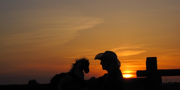
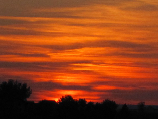
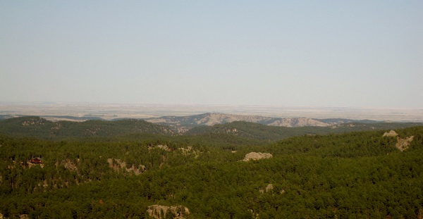
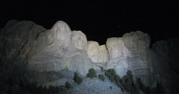
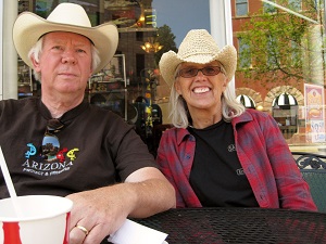
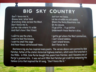
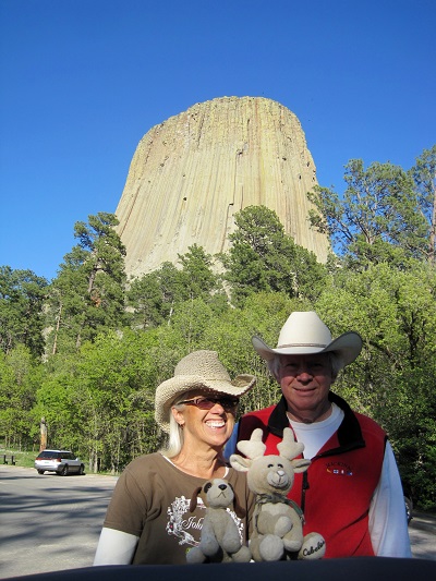
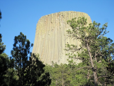
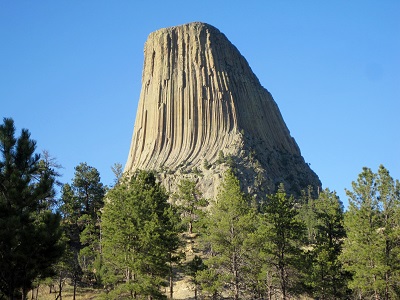
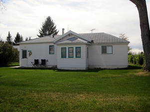
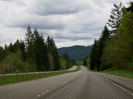
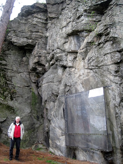
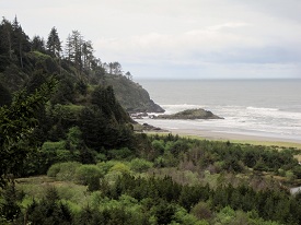
Somethings just defy description!

badlandsmapa


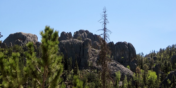
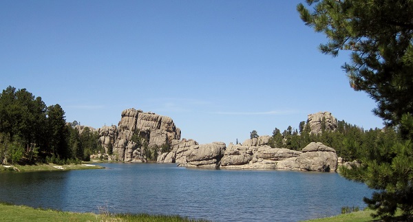
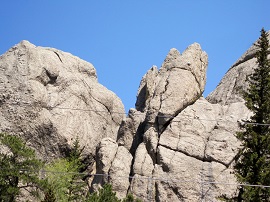
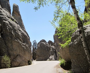
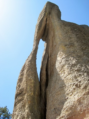
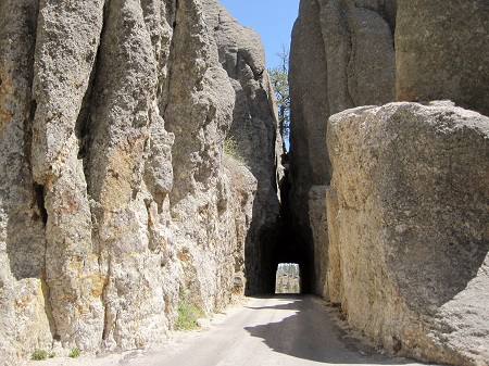
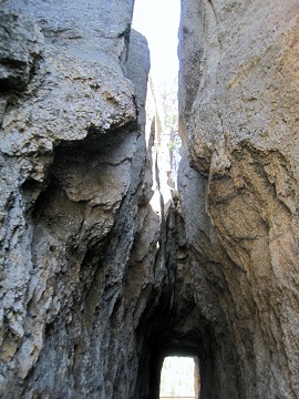
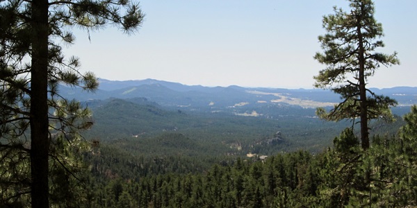
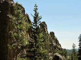
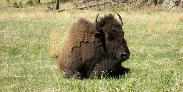
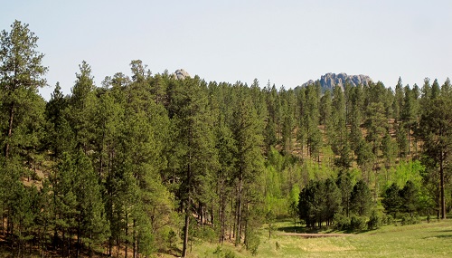
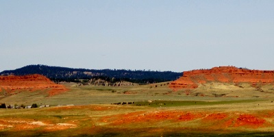
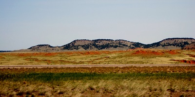
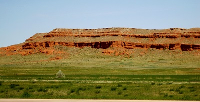
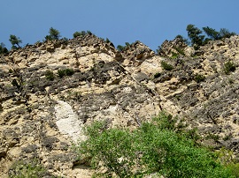
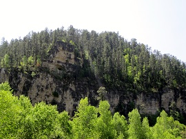
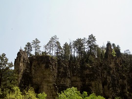
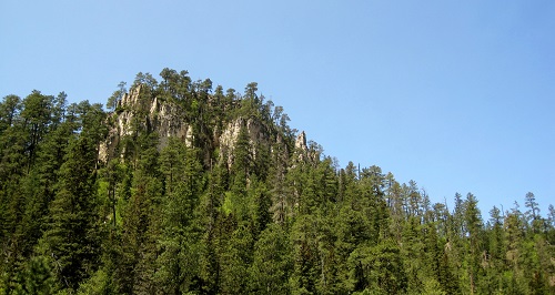
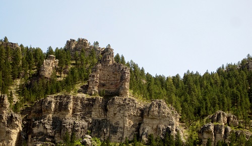
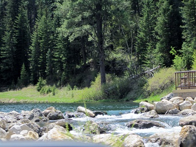
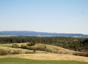
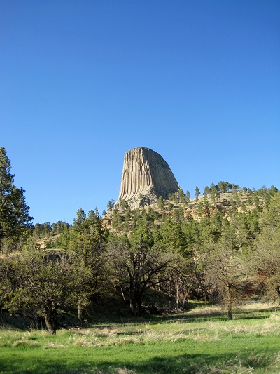
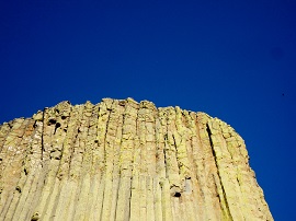
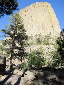
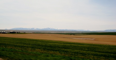
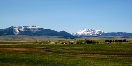
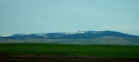
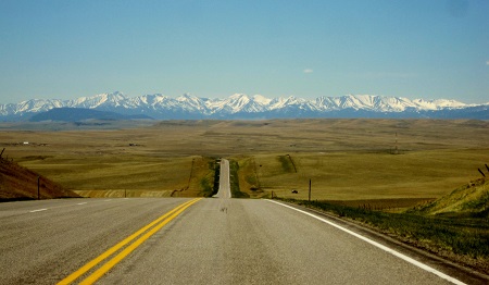
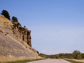
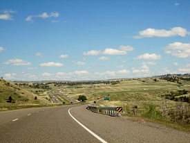
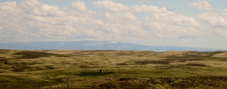
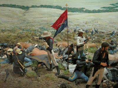
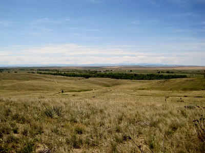
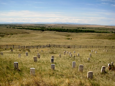
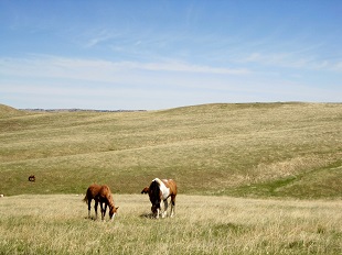
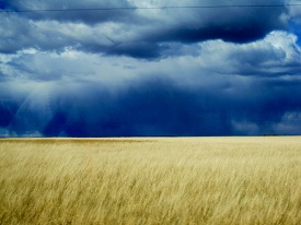
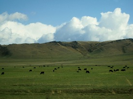
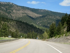
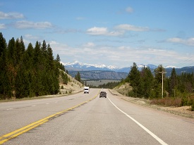
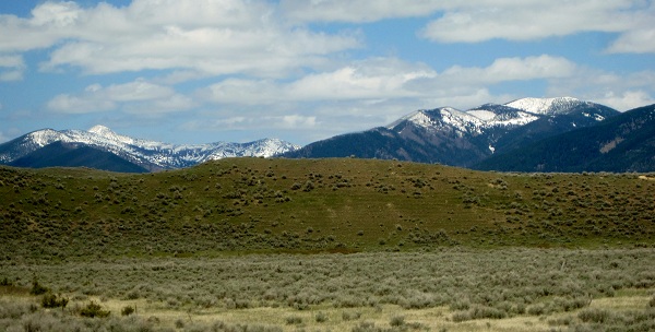
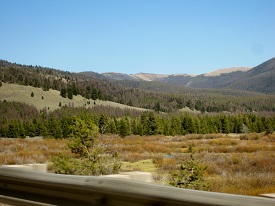
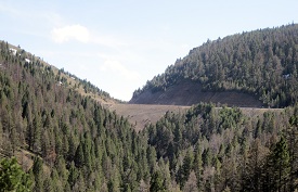
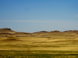
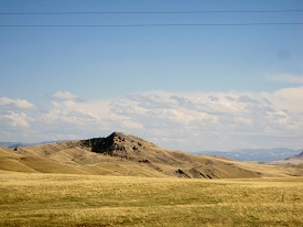
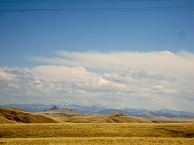
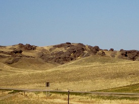
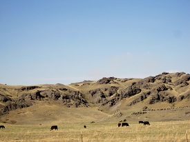
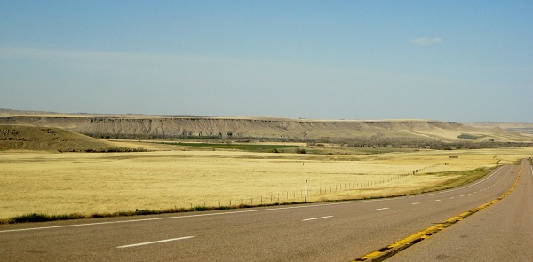
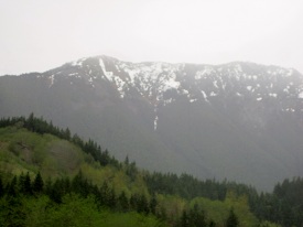
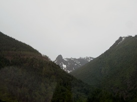
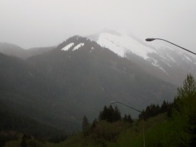
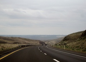
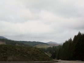
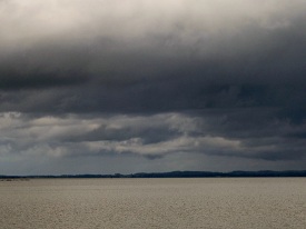
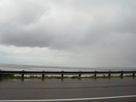
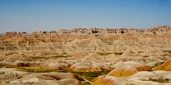
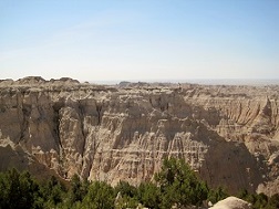
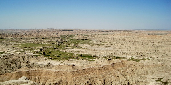
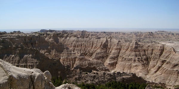
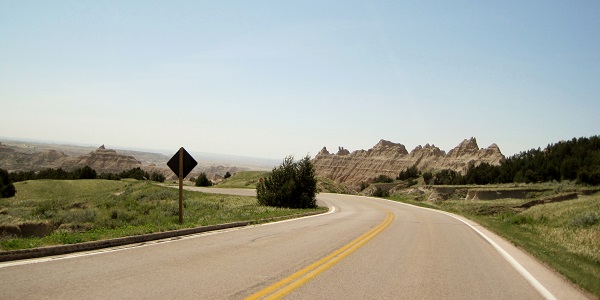
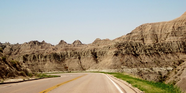
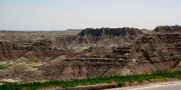
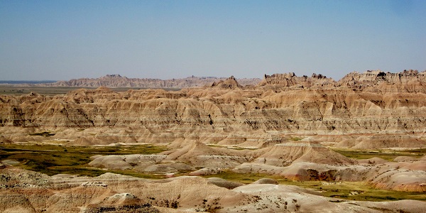
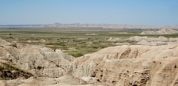
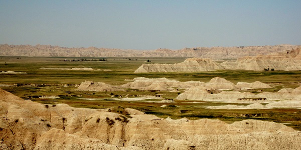
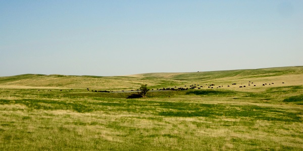
“They call it The Wall (not to be confused with Pink Floyd’s Wall). It extends for a hundred miles through the dry plains of South Dakota—a huge natural barrier ridging the landscape, sculptured into fantastic pinnacles and tortuous gullies by the forces of water. Those who pass through the upper prairie a few miles north might not even know it exists. Those who traverse the lower prairie to the south, however, can’t miss it; it rises above them like a city skyline in ruins, petrified.” (National Geographic)


IMG_7628a

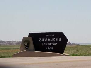
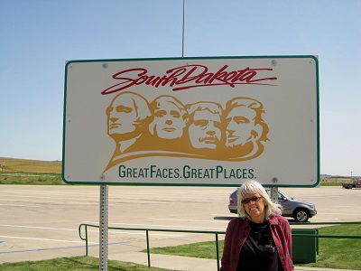
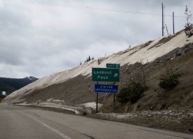
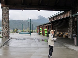
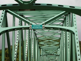
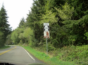
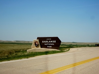
One would think that a National Park could get a little thing like signage right!

No the enter sign isn’t backward!

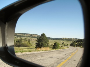
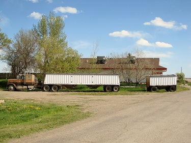
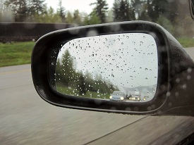
We didn’t get a picture of the sign coming in the other end of the Park, so we took this one in the mirror leaving. Clever – huh?


IMG_7529a


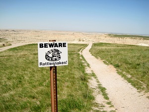
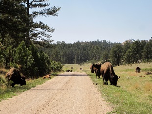
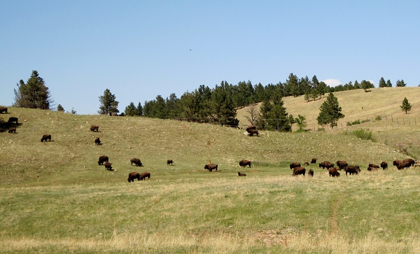
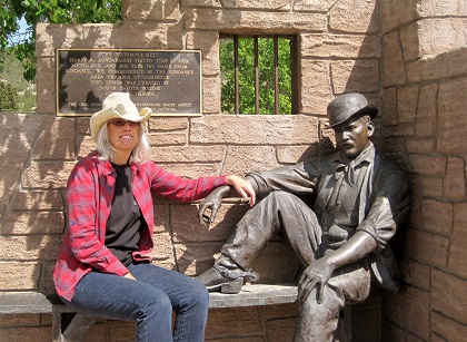
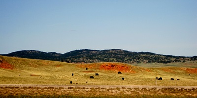
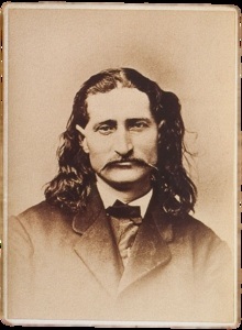
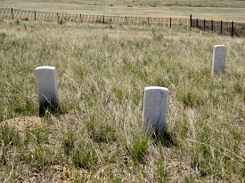
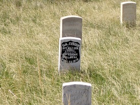
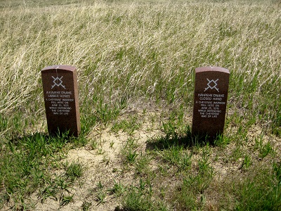
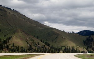
The Badlands are part of the Outlaw Trail leading from Saskatchewan, Canada to Mexico forged by Butch Cassidy and the Hole-in-the-Wall Gang (including Mary’s grandmother’s boyfriend – the Sundance Kid), the South Dakota Badlands isn’t for sissies.


IMG_7530aIMG_7533aIMG_7532aIMG_7531a

IMG_7534aIMG_7535a

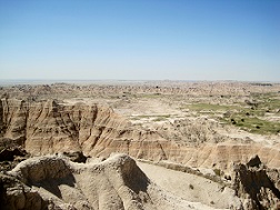
Interesting piece of trivia: The 1973 movie “Badlands” staring newcomer Martin Sheen along with Sissy Spacek, followed loosely the killing spree of Charles Starkweather and his girlfriend, Caril Ann Fugate, in 1959.   And, we continue to bring you interesting facts to astound your friends: Badlands National Park contains the world’s richest deposits of fossils from the Oligocene epoch (the transition period between the earlier and later Tertiary period – ain’t that great?). Paleontologists have uncovered the remains of ancient three-toed horses, tiny deer-like creatures, turtles, a saber-toothed cat and Martin Sheen’s toe nail clippings.  During World War II, the South Unit area of Badlands National Park was used by the army as a practice aerial bombing range. Despite cleanup efforts, the South Unit still contains some unexploded munitions. (Told you it wasn’t for sissies – well maybe Sissy Spacek.)

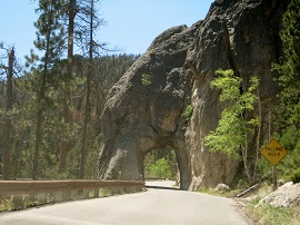
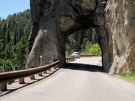
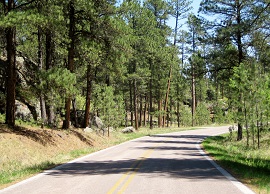
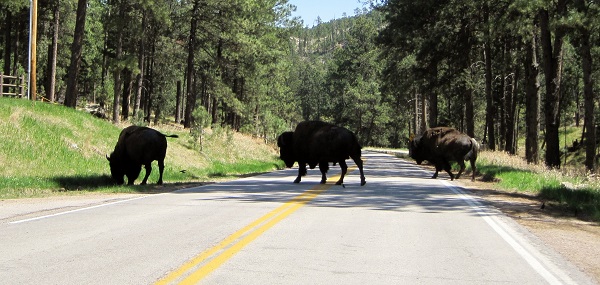
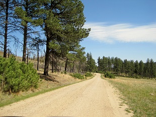
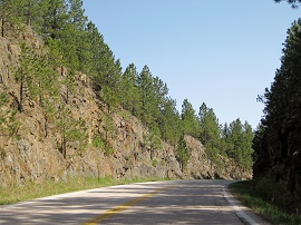
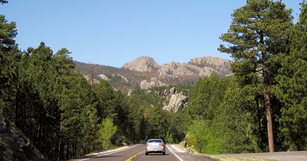
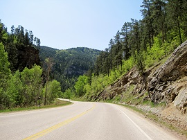
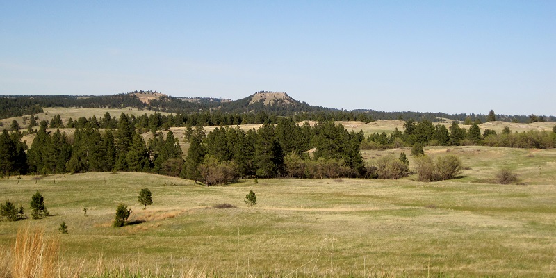
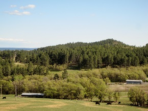
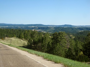
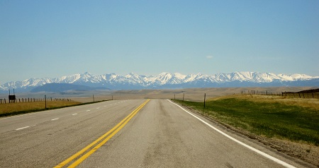
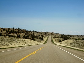
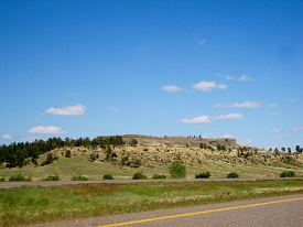
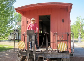
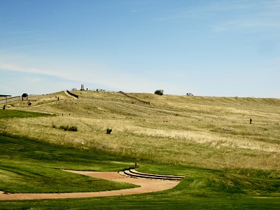
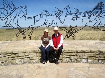
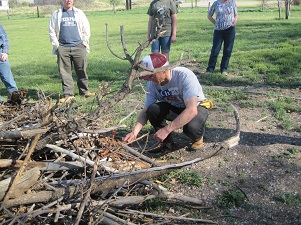
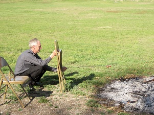
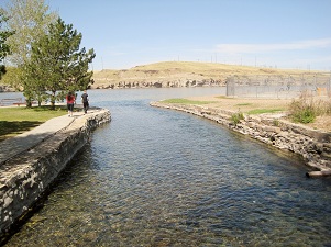
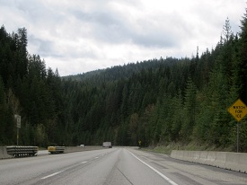
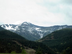
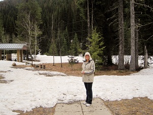
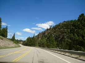
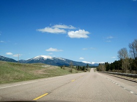
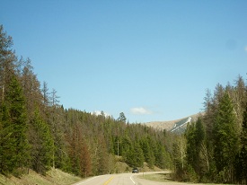
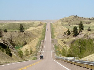
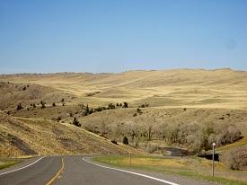
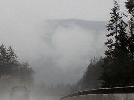
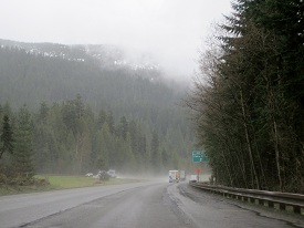
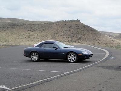
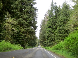
Being fearless, we mounted our trusty steed and ventured forth.
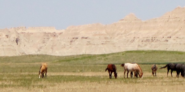
IMG_7605a

No!  Not those this:IMG_7585a

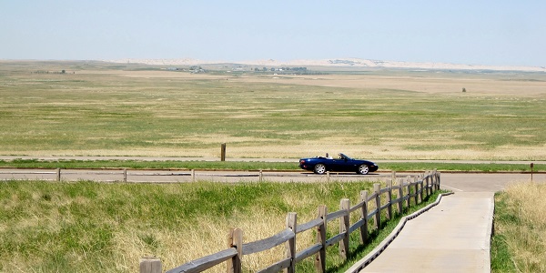
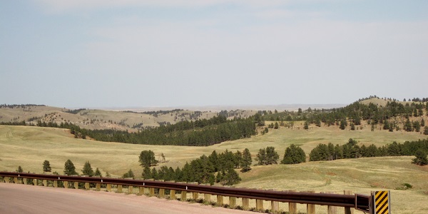
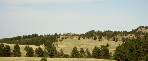
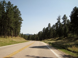
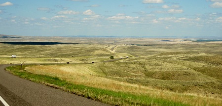
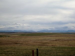
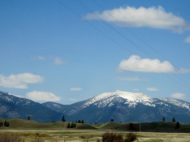
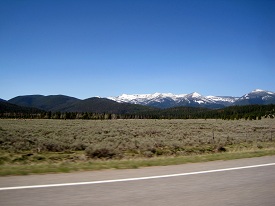
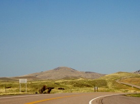
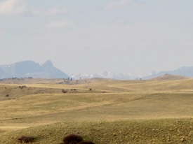
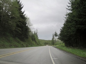
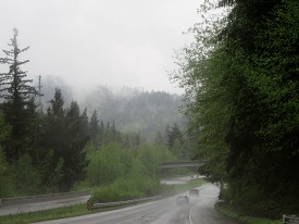
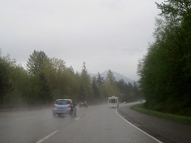
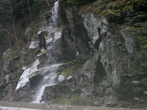
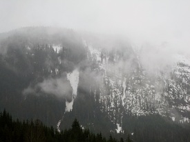
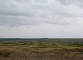
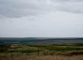
and took a drive: Jumping Badlands  (remember if it’s blue it’s clickable)


IMG_7536a

IMG_7539a IMG_7548a

IMG_7543a IMG_7540a IMG_7541a IMG_7542aIMG_7555aIMG_7558aIMG_7562aIMG_7564a


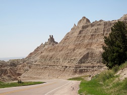
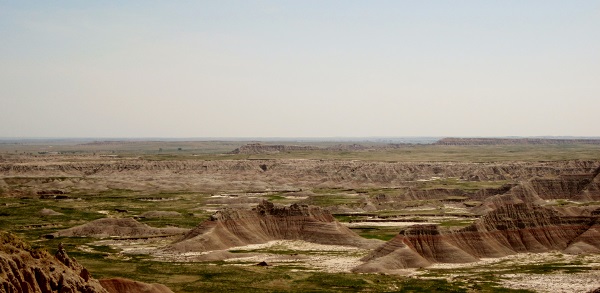
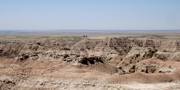
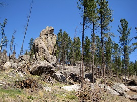
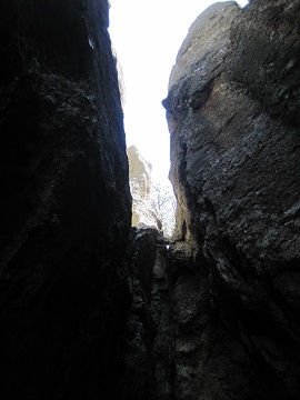
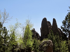
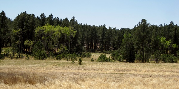
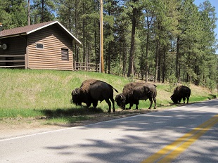
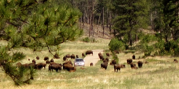
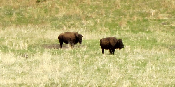
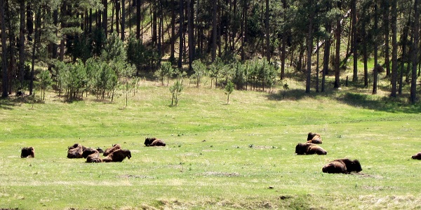
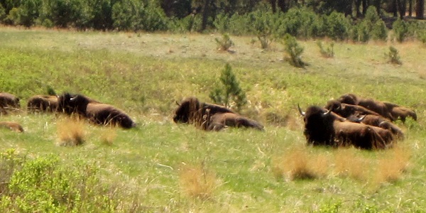
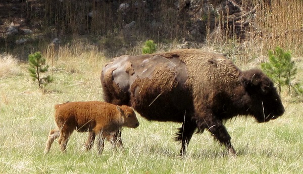
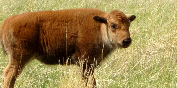
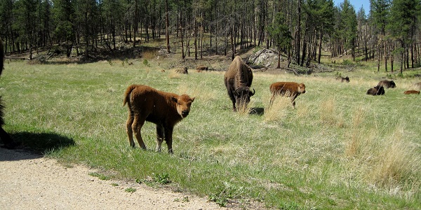
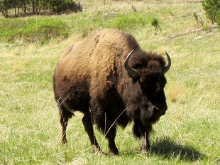
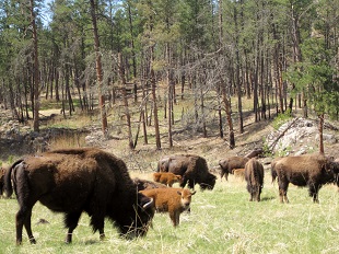
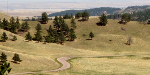
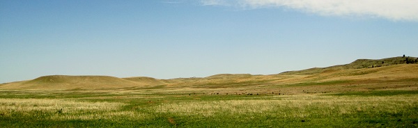
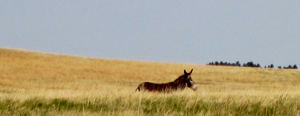
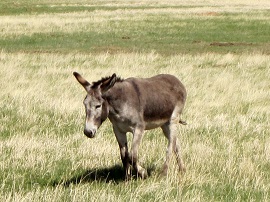
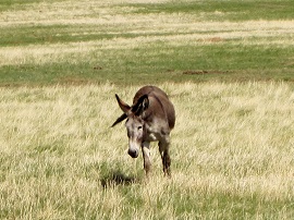
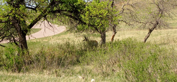
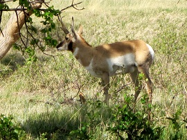
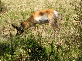
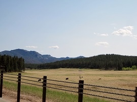
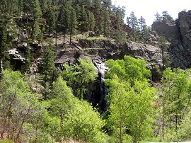
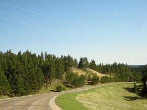
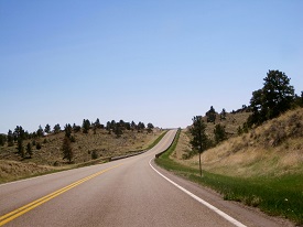
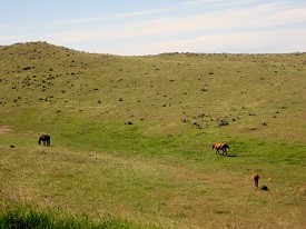
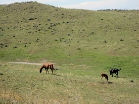
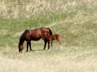
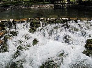
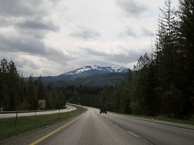
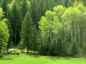
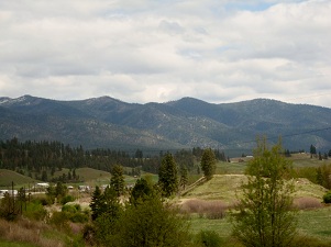
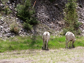
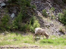
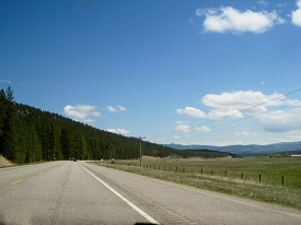
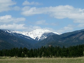
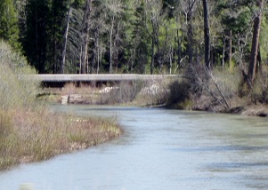
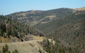
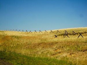
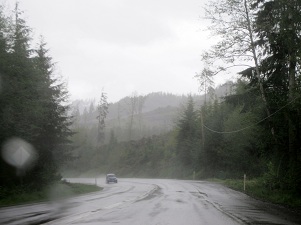
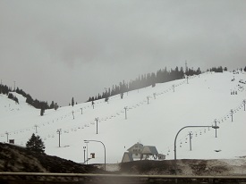
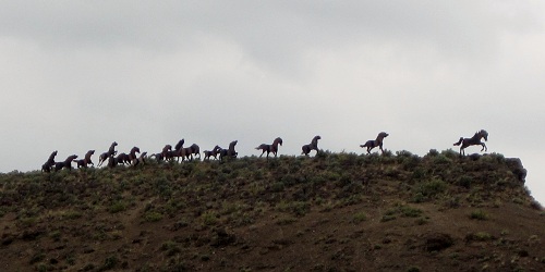
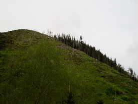
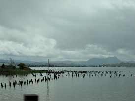
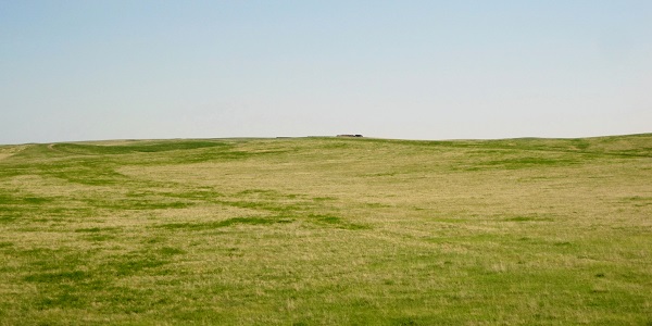
Frolicking in the Mako Sica:IMG_7578a


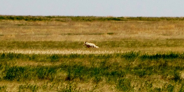
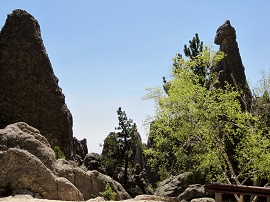
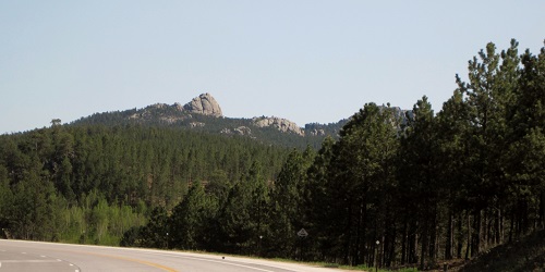
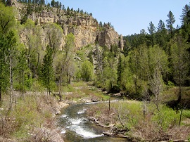
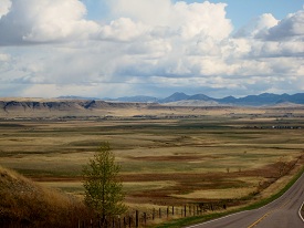
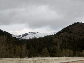
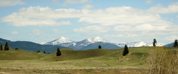
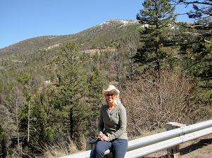
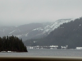
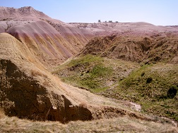
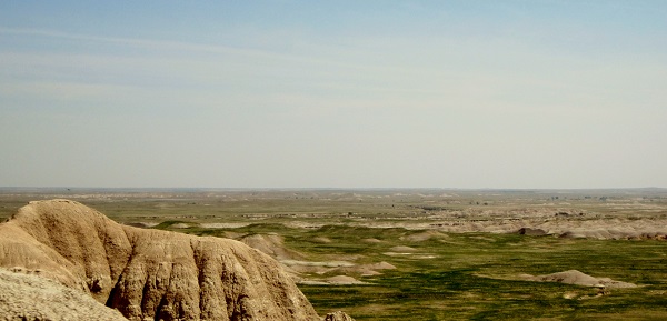
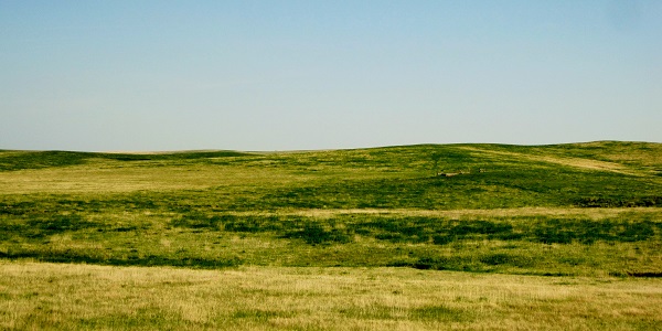
Pausing before heading on:IMG_7610a

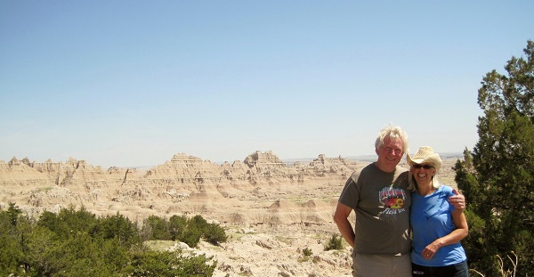
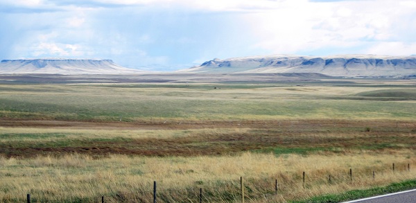
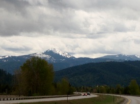
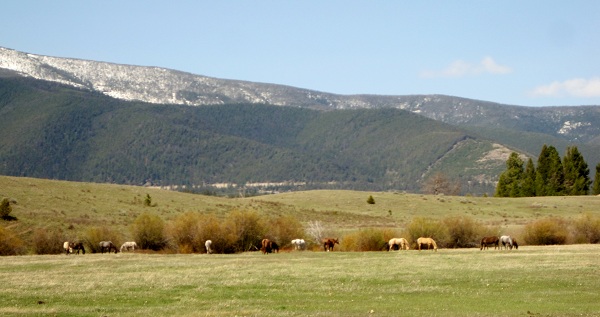
A little more frolicking:
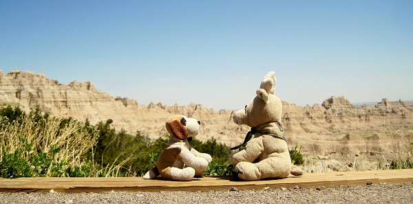
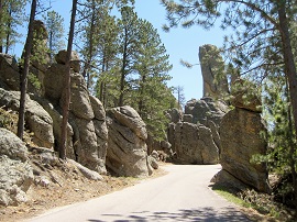
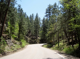
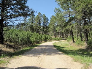
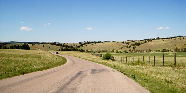
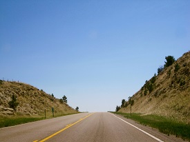
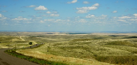
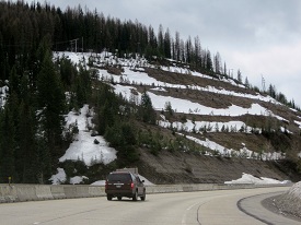
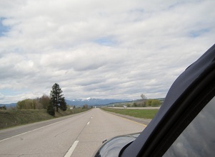
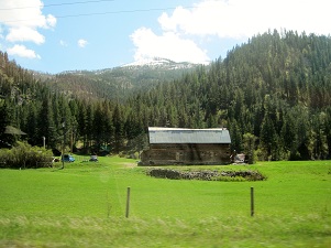
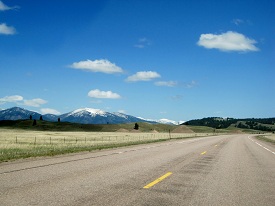
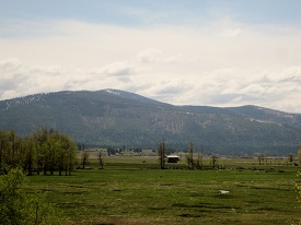
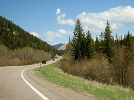
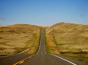
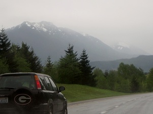
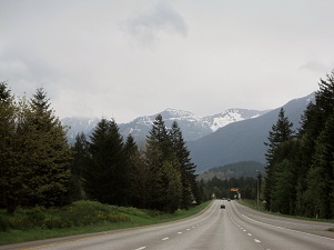
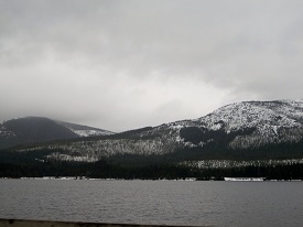
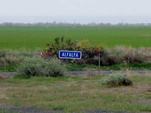
IMG_7611a

on the road again:IMG_7602a
IMG_7626a


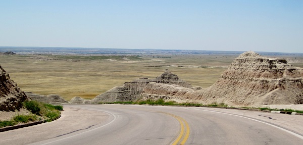
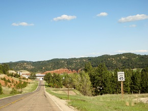
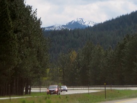
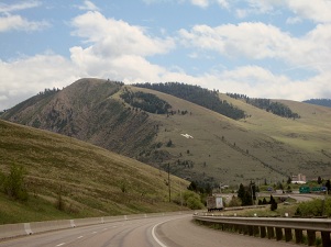
and away we go..getting the right side of the sign.


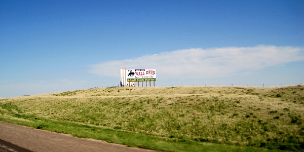
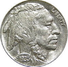
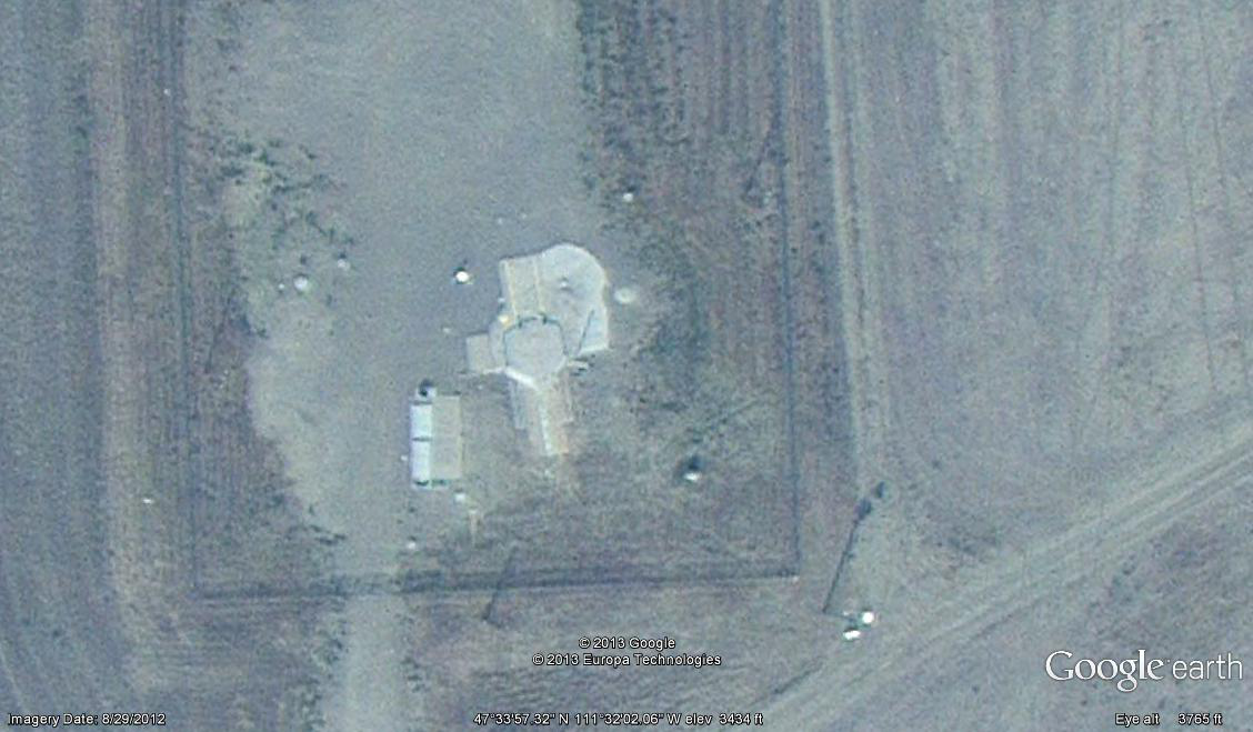
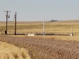
Near by is the Minuteman Missile Museum:IMG_7629a


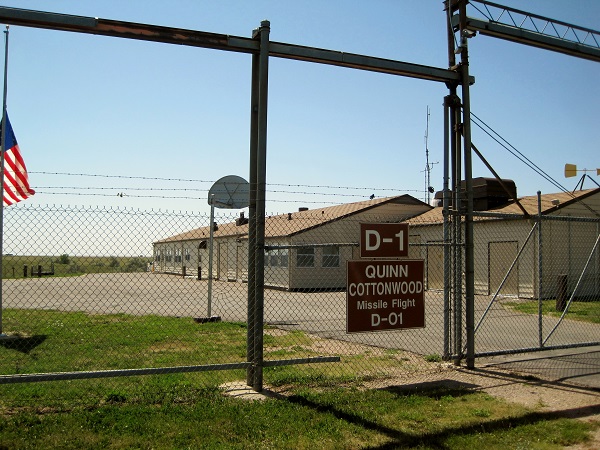
There were once 1000 of the Minuteman II Missiles spread over North and South Dakota, Wyoming and Missouri. Today there are 450 Minutemen taken their place. As a side note it took 1000 Minutemen to equal the Titan II system that I was a part of – just saying..

IMG_7630a

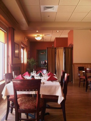
Nice restaurant above the control capsule though…

IMG_7632a


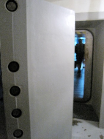
to get into the launch control capsule you took a small elevator from the “restaurant” above and entered through a series of blast doors.


IMG_7633a

the capsule itself was a big sewer pipe laid on its side and stuffed full of racks of electronics, communications equipment and barely enough room for the two launch control officers whose job it was to make people glow in the dark. Each Control Center controlled 10 missiles with 1.2 megatons warheads. (much like our government’s budget, its hard to visualize really large amounts of things. A megaton is the explosive power of one million tons of TNT..or 4 billion sticks of dynamite…. still can’t see it? how about a train of box cars over 10 miles long. Titan II’s warhead was the equivalent to a train of cars 100 miles long..Now think about what a trillion dollar budget is. The stuff you learn here is just great!)

IMG_7631a


of course it pays to have a sense of humor when you’re making people glow…


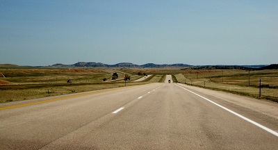
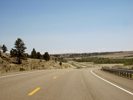
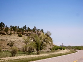
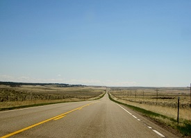
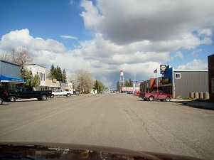
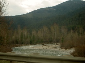
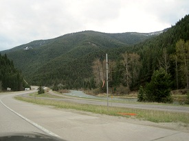
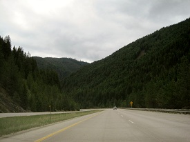
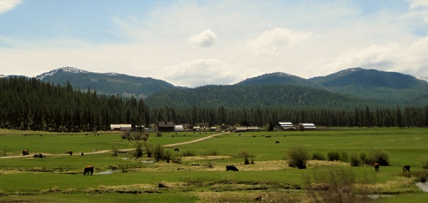
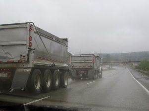
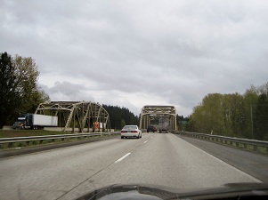
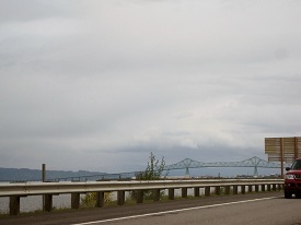
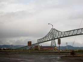
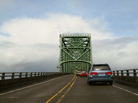
Fun time was over and once again we hit the road:IMG_7637aIMG_7640aIMG_7639aIMG_7638a

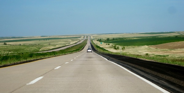
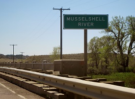
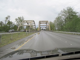
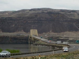
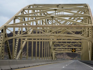
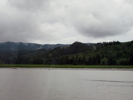
Cross over the “Big Muddy” (Missouri River):IMG_7642a

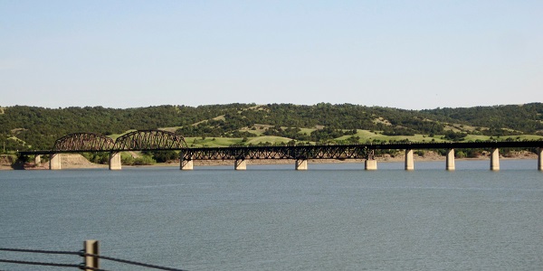
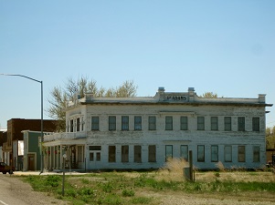
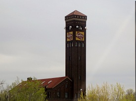
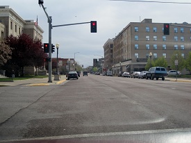
Into Mitchell, South Dakota and the World’s Only Corn Palace:IMG_7646a

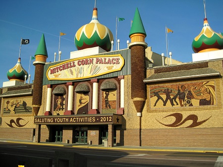
Why someone would build a Palace for corn is anybody’s guess. However: “For over 120 years, the World’s Only Corn Palace has attracted the unusual, the notable, and the road-weary. This year, this whimsical building will undergo a royal transformation before your very eyes!

In addition to the annual redecorating, parts of the Palace will be under corn-struction while we work to bring an even greater experience for you to visit. New ear-chitecture, new interactive exhibits, and a new, welcoming design will make the Corn Palace more exciting than ever. The theme of 2015 is “South Dakota’s 125th”.  (Quote shamelessly lifted from the Corn Palace websight http://cornpalace.com/.) I don’t know, seems a little corn-y to me and yes, the murals are made of corn. An interesting side light in 1904–1905, the city of Mitchell mounted a challenge to the city of Pierre in an unsuccessful attempt to replace it as the state capital of South Dakota.

cp

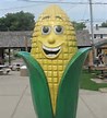
In 2007, the Corn Palace received $25,000 in DHS funding for a camera system useful for many purposes including, as reported by the Mitchell Daily Republic, to protect a “new Fiberglass statue of the Corn Palace mascot Cornelius” in 2009.


MRAP

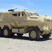
I wonder if the Corn Palace also got a MRAP and grenade launchers?


Well enough with the cornpone, on with the trip!…… Well maybe not…ya see someone else wanted my camera and “borrowed” it never to be seen again (I hope they enjoyed the rest of the pictures). So… we rolled through Minnesota and into Wisconsin, saw a really weird bunch of structures in the field along the highway.. looked a lot like some sort of devil worship stuff.. might have been the freedom from religion foundation headquarters.  Down into Illinois, we bypassed Chicago by driving through the county till we were 50 miles south and then went east until Indiana then home. Nor much to say about all that, except we were glad to be back in Michigan.

Thought I would leave you with this: Happy Trails

I still can’t believe they sold Trigger.


Rocks & Needles, Buffalo Chips, and a really big Drug Store

IMG_7368a


Needles?   Do you see Needles?    I don’t see any Needles!

We dragged ourselves away from the crazy horses and made our way along Route 16 to Custer State Park named for …… wait for it…… George Armstrong Custer.  Custer State Park is the largest state park in South Dakota and a really cool place. No! I mean that. I would have liked to have stayed awhile to really check it out but……

IMG_7370a

Needles Highway is within the park and is named after the needle-like granite formations that the road winds through.

The roadway was carefully planned by former South Dakota Governor Peter Norbeck ( when was the last time you heard of a politician doing…you know…actual work), who marked the entire course on foot and by horseback. Construction was completed in 1922.

IMG_7372aIMG_7373a

IMG_7376a


The dreaded South Dakota striped attack – monk!


IMG_7380aIMG_7382a IMG_7386a

IMG_7387aIMG_7389a


IMG_7390a


No Semi’s allowed…


IMG_7391a


Eye of the Needle……… I don’t know I just don’t see it.


IMG_7393a


Yes, the tunnel really is 6 inches high and 4 inches wide!


IMG_7394aIMG_7395a


IMG_7400a

but we squeezed thru…

IMG_7412aIMG_7410aIMG_7409aIMG_7416a

IMG_7420aIMG_7422aIMG_7421a

IMG_7426a


We had lunch at the Blue Bell Lodge in the Park.


IMG_7429a


Blue Bell Lodge advertises itself being “as comfortable as a pair of old blue jeans”.

Mary thought the saddle stools was a nice touch.


After lunch we started out again, I was driving and kinda gawking out the left of the car when Mary said “do you think you should STOP!” …..or something like that.

IMG_7431a


So I stopped. Somewhere in the back of my mind I heard our friends in Montana saying “Buffalo don’t do fences…they just go thru like they weren’t there. Sitting there I was wondering if they did Jags.

IMG_7432a


They really weren’t much interested in us or the Jag and just wanted to cross the road. Which begs the question: Why did the buffalo cross the road?


IMG_7435aIMG_7437aIMG_7440a

How should I know I don’t speak buffalo!

IMG_7456a


For some strange reason I decided to take this gravel fire-trail road thing that the Jag just loves….


IMG_7443a


…and came upon this…


IMG_7454a


IMG_7450a

IMG_7448aIMG_7444aIMG_7455a


As the other great  philosopher from what is now Oklahoma, Roger Miller, once said:
“Well, ya can’t roller skate in a buffalo herd
Ya can’t roller skate in a buffalo herd
But you can be happy if you’ve a mind to”


IMG_7452aIMG_7446a


Oh, come on now!  You know who the first great philosopher from what is now Oklahoma is!  Just think about it a little bit.  Want a hint?  “The only difference between death and taxes is that death doesn’t get worse every time Congress meets.”  Still don’t know?  Try – “Everything is changing. People are taking the comedians seriously and the politicians as a joke.”   Stumped?   How ’bout  “I never met a man I didn’t like”.

“There is nothing as stupid as an educated man if you get him off the thing he was educated in.”  Will Rogers 

It is amazing to me how much Will Rogers’ comments from the 1930’s apply to today. Goggle him sometime!

IMG_7457a


We skated on down the road….


and found where the deer and the antelope roam:

IMG_7459aIMG_7462a


Democrats, too:

IMG_7464a

IMG_7467aIMG_7466a

Something in the bushes:

IMG_7468aIMG_7471aIMG_7470a


Heading out of the Park:

IMG_7474aIMG_7476aIMG_7479a

Wait! Wait! This just in!  You too, can own your very own fence busting, chip making, rootin, tootin living souvenir of the American West. A one time only – never to be repeated, invitation only, must be present to win, blue light special, midnight sale, so easy a caveman can do it, it takes a licking and keeps on ticking,…. where’s the beef?, ….whew!….Sorry got carried away there in the excitement. The park has an annual buffalo roundup and auction in September of each year (Sept. 26, 2014) in which the bison in the park are rounded up, with several hundred sold at auction.

IMG_7482a

So bring your checkbook if you dare!

Moseying on down the road we headed to Wall Drugs (where we Fedexed our buffalo home)

IMG_7484a

Attention! Learning provided by Wikipedia:

IMG_7488a

Wall Drug Store, often referred to simply as “Wall Drug,” is a tourist attraction located in the city of Wall, South Dakota. It is a shopping mall consisting of a drug store, gift shop, restaurants and various other stores. Unlike a traditional shopping mall, all the stores at Wall Drug operate under a single entity instead of being individually run stores. The New York Times has described Wall Drug as “a sprawling tourist attraction of international renown [that] takes in more than $10 million a year and draws some two million annual visitors to a remote town.”

IMG_7489a

The small town drugstore made its first step towards fame when it was purchased by Ted Hustead in 1931. Hustead was a Nebraska native and pharmacist who was looking for a small town with a Catholic church in which to establish his business. He bought Wall Drug, located in a 231-person town in what he referred to as “the middle of nowhere,” and strove to make a living. Business was very slow until his wife, Dorothy, got the idea to advertise free ice water to parched travelers heading to the newly opened Mount Rushmore monument 60 miles to the west. From that time on business was brisk. Wall Drug grew into a cowboy-themed shopping mall/department store. Wall Drug includes a western art museum, a chapel based on the one found at New Melleray Abbey near Dubuque, Iowa, and an 80-foot  Apatosaurus that can be seen right off Interstate 90.

Ted Hustead died in 1999. The following day, the governor of South Dakota began his annual State of the State address by commemorating Hustead as “a guy that figured out that free ice water could turn you into a phenomenal success in the middle of a semi-arid desert way out in the middle of someplace.”  So now you know a lot more about Wall Drugs than you ever thought possible. Don’t you feel better?

IMG_7523a


IMG_7497a

Our home away from home in Wall..


hanging out….


IMG_7492a


…inside… even the towels matched…


IMG_7522a


…the crew…


IMG_7503a

Mary communes with Horse

IMG_7514a

Good night from Wall.


Old Presidents with Big Heads and a Crazy Horse


IMG_7268


But first we had to get the Lead out. I mean get out of Lead.


IMG_7269a


Um…not only did they get the lead out, but the trees as well!


IMG_7270a


Moving on down the road…


..and we came across this lake.

IMG_7279a

Pactola Lake is the largest lake (reservoir) in the Black Hills and was created by the Pactola Dam. On the bottom of the lake is the  town of Pactola, an old mining camp submerged when the dam was built. Hopefully they gave the miners really long straws to breathe through.


Moved down the road some more…

IMG_7287a IMG_7284aIMG_7288a IMG_7291a


..and further yet….

IMG_7292aIMG_7293a


IMG_7295a


..until we hit a fork in the road. After cleaning up the debris we took the next right into Keystone and Mt. Rushmore.


IMG_7297a


thru the tunnel we went and …


IMG_7298a


..around the corner..


IMG_7299a

..and into Keystone, population 337 give or take 5 or 6,000 during tourist season. Keystone was the home of Carrie Ingalls, Laura Ingalls Wilder’s sister..just another no- charge bit of trivia for you to enjoy. – Good night John Boy!


Our home away from home in Keystone:

IMG_7344aIMG_7343a


IMG_7300a


Keystone’s reason for being and our reason for being in Keystone:


WARNING!  WARNING!  WARNING!

 LEARNING AHEAD:

Mt. Rushmore was originally known to the Lakota as the Six Grandfathers, representative of the six sacred directions: west, east, north, south, above, and below.  Following a series of military campaigns from 1876 to 1878, the United States asserted control over the area, a claim that is still disputed on the basis of the 1868 Treaty of Fort Laramie (giving the Black Hills to the tribes forever, remember?)  Among American settlers, the peak was known variously as Cougar Mountain, Sugarloaf Mountain, Slaughterhouse Mountain, and Keystone Cliffs. It was named Mount Rushmore during a prospecting expedition (they discovered lead) by Charles Rushmore and David Swanzey, Laura Ingalls Wilder’s sister Carrie’s hubby. So why didn’t they name it Mt. Swanzey instead of after Rushmore, the prominent New York lawyer? Oh, I don’t know.  There wasn’t that fun?

On to Mt. Grandfathers..er..Mt. Swanzey…. Mt. Little House? ….OK Mt. Rushmore:

IMG_7301a

See it?

IMG_7303a

How ’bout now?

IMG_7306a

Getting closer.

IMG_7307a


We rushed to Mt.Rushmore not knowing for sure if it was open for business, being so early in the season..


IMG_7308a


…but it was, so we went back to Keystone  dumped our stuff at our EconoLodge suite, said Hey! to Carrie and came back.

(Ingalls!  Forgetful aren’t we?)


IMG_7310aIMG_7311aIMG_7312a

Taken directly from Wiki so be careful about the LEARNING thing –

“Historian Doane Robinson conceived the idea for Mount Rushmore in 1923 to promote tourism in South Dakota. In 1924, Robinson persuaded sculptor Gutzon Borglum to travel to the Black Hills region to ensure the carving could be accomplished.stone_mountain Borglum had been involved in sculpting the Confederate Memorial Carving, a massive bas-relief memorial to Confederate leaders on Stone Mountain in Georgia, but was in disagreement with the officials there. The original plan was to perform the carvings in granite pillars known as the Needles (more on the Needles later). However, Borglum realized that the eroded Needles were too thin to support sculpting. He chose Mount Rushmore, a grander location, partly because it faced southeast and enjoyed maximum exposure to the sun. Borglum said upon seeing Mount Rushmore, “America will march along that skyline.” Congress authorized the Mount Rushmore National Memorial Commission on March 3, 1925. President Coolidge insisted that, along with Washington, two Republicans and one Democrat be portrayed.

Between October 4, 1927, and October 31, 1941, Gutzon Borglum and 400 workers sculpted the colossal 60 foot high carvings of U.S. presidents George Washington, Thomas Jefferson, Theodore Roosevelt, and Abraham Lincoln to represent the first 130 years of American history. These presidents were selected by Borglum because of their role in preserving the Republic and expanding its territory. The image of Thomas Jefferson was originally intended to appear in the area at Washington’s right, but after the work there was begun, the rock was found to be unsuitable, so the work on the Jefferson figure was dynamited, and a new figure was sculpted to Washington’s left.

In a canyon behind the carved faces is a chamber, cut only 70 feet into the rock, containing a vault with sixteen porcelain enamel panels. The panels include the text of the Declaration of Independence and the Constitution, biographies of the four presidents and Borglum, and the history of the U.S. The chamber was created as the entrance-way to a planned “Hall of Records” which was never completed”  OK learning on pause – wasn’t that fun?

Clifford


We met a very nice older gentleman Don ” NIck” Clifford (and his wife Carolyn) who had been one of the men who carved the mountain. Bought his book ” Mount Rushmore Q & A”  and, as it wasn’t real busy that day, told us about some of his experiences on the mountain.


IMG_7313a


View from the mountain:

IMG_7322a IMG_7323a IMG_7321a


IMG_7324a


Heads with heads


The sun was beginning to set so I tried to get artistic.

IMG_7326a

IMG_7338a


IMG_7339a

It was the opening night of the “night” show. They had the veterans in the audience come down and introduce themselves. Because it was chilly I decided not to go down and have to climb back up the stairs.


IMG_7347a


The next morning we said adieu to George and Friends and stared out for Custer State Park…


 on the road again..

IMG_7351a


IMG_7361a


but first we go a little crazy…


Learning Alert!

In 1929, Henry Standing Bear, a Lakota elder, initiated the project to honor Crazy Horse by writing to sculptor Korczak Ziolkowski, saying in part, “My fellow chiefs and I would like the white man to know that the red man has great heroes, too.”  Ziolkowski had worked on Mount Rushmore in 1924 under Gutzon Borglum.

IMG_7364a


After making models, Ziolkowski started blasting for the monument in 1948.


IMG_7358a


The memorial is a non-profit undertaking, and receives no federal or state funding.


IMG_7360aThe Memorial Foundation charges fees for its visitor centers and earns revenue from its gift shops. Ziolkowski reportedly was offered $10 million for the project from the federal government on two occasions, but he turned the offers down. He felt that the project was more than just a mountain carving, and he feared that his plans for the broader educational and cultural goals of the memorial would be overturned by federal involvement. Ya think?!!

IMG_7363a

Ziolkowski died in 1982. Sixteen years later in 1998, the face of Crazy Horse was completed and dedicated. Interesting stuff about Crazy Horse and the Monument: No one knows what Crazy Horse looked like (well, maybe his mother) as no pictures were ever taken of him, except for maybe the one at Custer Battlefield Museum in Garryowen, Montana.

Trivia Alert: Garryowen is located on the Little Big Horn battlefield and is a private town owned by Chris Kortlander with a Conoco gas station and convenience store, a Subway, an arts & crafts store called “The Trading Post,” and the Custer Battlefield Museum. This town is currently for sale, but an auction in August 2012 was cancelled after no one registered to bid. It has a population of two. You just can’t learn stuff like this anywhere else..

The Memorial itself is big – how big you ask? Well it is said you can take all four heads from the Mt. Rushmore and put them on Crazy Horse’s out stretched arm.

The Ziolkowski family have been working on this project from 1948 to present day (65 years). Ziolkowski’s wife Ruth and seven of their ten children work at and on the memorial. Because they don’t want the Feds messing with the Monument, money has always been an issue. One would think that all those Indian run casinos would chip in but that’s just me.


IMG_7367a


Crazy Horses (ya, I know)


Next up Rocks & Needles, Buffalo Chips, and a really big Drug Store.

Sundance (where a legend was born), Wild Bill and Lead

Escaping from the Alien Prairie Dogs and who knows what fate, we made our way toIMG_7183a:


Here’s the thing about Sundance (named after the Sun Dance ceremony practiced by the Plains Tribes) one of its residents, or I should say resident of the Sundance jail was one Harry Longabaugh.

IMG_7186a

Who is Harry Longabaugh you ask? Why the Sundance Kid of course. You remember Butch Cassidy and the Sundance Kid, the Wild Bunch and of course Etta Place, the Sundance Kid’s girlfriend and Mary’s grandmother?  (for a more detailed account of this astonishing supposition please see the section entitled  Florida – Old Friends – Family – And Our New Best Friend Rudy posted March 19, 2012, near the bottom of the section.) 


Ettas Place


After Mary completed her reminiscing we found Etta’s Place, a nice restaurant, where we had one of the best steak dinners we had on the entire trip. We tried hard to convince the waiter that we should have the “family” discount but…it wasn’t happening.


Roadeway Inn

We stayed the night at the local Roadeway Inn. They had just reopened for the season that day! We were the only guests and the young man had to make change out of his own pocket for the things Mary bought. We did get the “first guest of the season” discount but not the “family” discount.


The next morning we moseyed our way out of town and hit the road for South Dakota.

IMG_7187a

Pics from the road to South Dakota (I-90) Ya, I know I’ve groused about interstates but this one, or this section at least, wasn’t so bad:


IMG_7188a IMG_7189a IMG_7190a IMG_7194a

IMG_7193a


..and here we are.


IMG_7192a

..a room with a view?  Nope- just some artsy stuff at the South Dakota Welcome Center.

South Dakota has lots of interesting stuff like the Black Hills, the Badlands, Mount Rushmore, Crazy Horse, Buffalo (ya I know – bison), the Badlands, Gold, Wall Drugs, the Corn Palace, Sturgis, Deadwood and Wild Bill just to name a few.

The Feds think it’s part of the “Midwest” but what do they know? When I went to school it was part of the Great Plains. Bet they didn’t ask Wild Bill and Calamity Jane. Midwest – ya right!


The southwest corner of South Dakota has “A LOT” of stuff to see packed into it, not least of which, is the Black Hills area. Caution learning ahead, boldly lifted from Wikipeda: The Black Hills are a small, isolated mountain range rising from the Great Plains of North America in western South Dakota and extending into Wyoming, The Black Hills encompass the Black Hills National ForestIMG_7197a and is home to the tallest peaks of continental North America east of the Rockies. The name “Black Hills” is a translation of the Lakota Pahá Sápa. The hills were so-called because of their dark appearance from a distance, as they were covered in trees.

After conquering the Cheyenne in 1776, the Lakota took over the territory of the Black Hills, which became central to their culture. The U.S. government signed the Fort Laramie Treaty of 1868, exempting the Black Hills from all white settlement forever. However, gold was discovered in-them-there-hills in 1874, as a result of George Armstrong (again what’s with the Armstrong) Custer’s Black Hills Expedition, erstwhile (means former) miners swept into the area in a gold rush altering the definition of forever. The US government re-assigned the Lakota, against their wishes (ya think?), to other reservations in western South Dakota and they all lived happily ever after – well there was that Little Big Horn thing involving George ARMSTRONG Custer.

Pic’s from the drive along Alt 14 (always good to drive on alternate routes -well- maybe not always):

IMG_7199a IMG_7200aIMG_7202a IMG_7203aIMG_7204a IMG_7210a IMG_7212a IMG_7214aIMG_7215a IMG_7224a IMG_7205a IMG_7208a


and a couple more:

IMG_7221aIMG_7226a


IMG_7225a


We stopped for a break..


IMG_7229a


along side the stream


IMG_7234a


hit the road again for…. Lead.


IMG_7238a

Lead? Who names their town Lead. “Hi, I’m from Lead, where you from?”

The city was officially founded on July 10, 1876, after the discovery of gold. – hence the name Lead. Lead’s population consists mostly of Alchemists and politicians which may be the same thing.


IMG_7242a


The road from Gold…er.. Lead leads past the mines and on to…


IMG_7246a


In 1874, Colonel George Armstrong Custer led an expedition into the Hills and found lead – I mean gold on French Creek near present-day Custer, South Dakota. The Black Hills Gold Rush and Deadwood was the result. But the miners felt there was just something lacking about their fair town so they got together and thought about it, passed a bottle around and thought about it, passed another bottle around, you get the picture, and finally sent for a wagon train led by “Colorado Charlie” Utter containing what were deemed to be needed commodities to bolster business – i.e. gamblers and prostitutes. Well, what else to you think a bunch of drunken miners were going to send for? One of the gamblers on that wagon train was James Butler Hickok and one of the “ladies” was Martha Jane Cannary (Burke) also known as Calamity Jane.

IMG_7245a


Deadwood:

IMG_7261aIMG_7266aIMG_7267a IMG_7262a


IMG_7264a


We had lunch at Mustang Sally’s. Deadwood hasn’t changed much (except for burning down twice) by that I mean nearly every building is some sort of gambling hall or casino even Mustang Sally’s was full of slot machines inside. (“Arizona” Tom with the “Montana Kid”)


IMG_7247a


After lunch we went to visit Wild Bill and Calamity at the Mount Moriah Cemetery.


IMG_7260aWe learned several interesting things about Wild Bill’s grave. He was originally buried in Deadwood’s first cemetery, Ingelside, by his friend “Colorado Charlie” Utter (remember the wagon train?). Ingelside filled up quick, lots of rowdy’s in town, and Charlie paid to have  Bill moved to the new Mount Moriah. Today, Ingelside is a housing development and they are still uncovering unmarked graves.


IMG_7259a

When Bill was dug up they found that he had “petrified” and was solid as a rock and perfectly preserved. Unfortunately the same could not be said of his grave marker. The original (at left)  had been whittled on by souvenir hunters to the extent that it had to be replaced by a statue which was destroyed by souvenir hunters and was replaced by a sandstone sculpture of Hickok. Which in turn was also was badly defaced, leading to its complete enclosure in a cage for protection. This was cut open by  souvenir hunters in the 1950’s and the statue removed, never to be seen again.


IMG_7249a

The current monument is bronze and really heavy, but who knows how long it will be there. People leave packs of cigarettes and playing cards at the foot.

Now would probably be a good time to mention how Wild Bill came to be in the ground in the first place.  On August 2, 1876, Hickok was playing poker at Nuttal & Mann’s Saloon. Hickok usually sat with his back to a wall. The only seat available when he joined the poker game that afternoon was a chair that put his back to a door. Twice he asked another player, Charles Rich, to change seats with him, and on both occasions Rich refused.IMG_7251a

A former buffalo hunter, Jack McCall (better known as “Crooked Nose Jack”  – why don’t we have great nicknames like that nowadays?), entered the saloon unnoticed by Hickok. McCall walked to within a few feet of Hickok, drew a pistol and shouted, “Damn you! Take that!” before firing at Hickok point blank. McCall’s bullet hit Hickok in the back of the head, killing him instantly. Hickok’s killing made famous the hand he was holding “Aces and Eights”,  the “Dead Man’s Hand”. Hickok had been in Deadwood all of four weeks. My dad never liked to sit with his back to a door and come to think of it neither do I, maybe there’s some of Wild Bill’s blood running in my veins. Could be..


IMG_7254a


Buried next to Hickok is Martha Jane Cannary (Burke) “Calamity Jane”. Some say she was Bill’s girlfriend, some others his wife and yet others that Bill didn’t want to have anything to do with her. Calamity claimed he was the love of her life.


IMG_7256a


and her dying wish was to be buried next to him.


220px-Wild_Bill_Hickok_sepia (2)220px-Calamity_jane

True Love???

All I can say is:


Next stop old Presidents and big heads.


Wyoming and a Close Encounter


We left Custer’s Last Roadside Stand for Wyoming passing through Crow and Cheyenne reservations.

IMG_7004aIMG_7005a

IMG_7006a

I’ve already mentioned the poverty of these places so I won’t again. The pic to the right is an illustration of the plight many of the Plains Indians. It is not a tee-pee, it is not even an occupied building, it is just a symbol.

.


IMG_7022a


..but there is Chief Dull Knife College.

Named after Chief Dull Knife, whose Cheyenne name translated to Morning Star.  He was noted for his active resistance to the Federal government.


IMG_7062a


Oh, give me a home….


IMG_7074a


Did you know Don’t Fence Me In was written by Bob Fletcher, a Montana State Highwayman.  -no not that kind He did the State historical markers in the ’30s. Cole Porter bought the poem from him and penned the song.


I put together a video montage of some of Montana for you as we leave the State. hope you like it and Roy Rodgers.


WYOMING – Things to Know:

wyomingSouthwest section of Wyoming was part of Spanish Empire and then Mexican California

John Coulter (member of the Lewis & Clark expedition – remember them?) sent a description back East of the Yellowstone region and was thought to have made it all up.

Wyoming was named by a guy in Ohio because of a poem written about a woman in Pennsylvania – “Gertrude of Wyoming” which talks about the Wyoming Valley in Pennsylvania . Ya’ just can’t make this stuff up.

Wyoming is the 10th biggest but the least populous – so if you need elbow room..

It has the nation’s first National Park – Yellowstone in 1872. Do you know what the               second National Park was?  Mackinac Island, Michigan in 1875 (pronounced Mac-i-naw     and later turned over to the State of Michigan to become Michigan’s first state park).

The continental divide forks in the south central part of the state in an area known as the Great Divide Basin. The waters that flow or precipitate into this area remain there and cannot flow to any ocean. So if you flush there’s nowhere for it to go?

Nearly half of Wyoming is Federal land, which is us, so go get a chunk.

OK enough learning. On the road again…

IMG_7104a


Looking back, Wyoming seems much like Montana..

IMG_7101a


…but soon we began to see trees and things..

IMG_7106a IMG_7107aIMG_7108aIMG_7110aIMG_7111aIMG_7113a

IMG_7114a


..and the road to Sundance. There was a road to Aladdin but we didn’t have a lamp with us.

More on Sundance latter.


IMG_7116a


The road took us right by Devils Tower


IMG_7125a


IMG_7128a


The gate was open and the only guards were these guys:

IMG_7131a IMG_7132a


So we went in.

IMG_7133a

Geologists agree that Devils Tower was formed by the intrusion of igneous material, but they cannot agree on exactly how that process took place.

 igneous – formerly molten: describes rock formed under conditions of intense heat or produced by the solidification of volcanic magma on or below the Earth’s surface. Careful don’t strain your brain! Did you see the Prarrie dog town. The road to Devils Tower goes right through. Wonder if the gov’t paid for the right-a-way?

IMG_7137a

While geologists can’t quite figure out Devils Tower or as the Lakota call it, Grizzly Bear Lodge. The Tribes tend to agree in form as to how the Tower came to exist. According to the Kiowa and Lakota Sioux, some girls went out to play and were spotted by several giant bears, who began to chase them. In an effort to escape the bears, the girls climbed atop a rock, fell to their knees, and prayed to the Great Spirit to save them. Hearing their prayers, the Great Spirit made the rock rise from the ground towards the heavens so that the bears could not reach IMG_7151athe girls. The bears, in an effort to climb the rock, left deep claw marks in the sides, which had become too steep to climb. (Those are the marks which appear today on the sides of Devils Tower.) When the girls reached the sky, they were turned into the star constellation the Pleiades. So  there ya go not only an explanation for “Grizzly Bear Lodge”, but one for the Pleiades constellation.

More of the “Lodge Tower” thing..

IMG_7149aIMG_7150a


IMG_7144a


The ever diligent Puppy thinks he may have found the tracks left by the bears.


IMG_7164a


We just fit right in. Don’t we?


IMG_7165a


As we were getting ready to leave some younger folks came back to their car after having climbed the Tower. We were going to climb up too, but it was getting late and we hadn’t had dinner yet and the sun would have been in our eyes. Anyway Mary asked them what was up there. After considering if they should tell us or not (our previously stated reasons not withstanding) they did. One of the group, obviously the jokester among them, said there was a Holiday Inn and a new McDonald’s up there. But we all know what’s really up there – don’t we?

IMG_7166a


Thinking it was best to vacate the premises before weird things started to happen, we made our way back down.


But then we had our own “close encounter”..

Sure they look like Prairie Dogs, act like Prairie Dogs but they’re Aliens – I tell you – Aliens!!


Well, gotta go. Mary has a date with the Sundance Kid and I’m playing poker in Deadwood.


Sioux, Cheyenne and Custer’s Roadside Stand

So we left brother Rex and his merry band of good ‘ole boys and girls and set out into the wilds of Montana.IMG_6861aIMG_6862a IMG_6866a

We drove southeast from Great Falls toward Billings, staying off the expressway as much as possible. This type of scenery isn’t available for those on I-whatevers.

IMG_6873a IMG_6878a IMG_6879a


rollin along..

IMG_6886aIMG_6891a IMG_6894a IMG_6895a


IMG_6897a

We thought hard about staying in the Adams hotel in Lavina, Montana. Later we learned that this hotel built in 1908 is being restored to its former glory. Click on Adams to see more. 28 meg file so might take awhile.

Rumor has it that it was Butch Cassidy, who built the place after surviving the shoot out in Bolivia. Ya, I know, but I love the cliff scene.

Moving along…

IMG_6898aIMG_6901aIMG_6900aIMG_6899aIMG_6902a IMG_6904a


..and into Billings.

IMG_6913a IMG_6914a


In July 1806, William Clark (of the Lewis and Clark Expedition -remember them?) passed through the Billings area. On July 25th he arrived at what is now known as Pompey’s Pillar and wrote in his journal “… at 4 P M arrived at a remarkable rock … this rock I ascended and from its top had a most extensive view in every direction.” Clark carved his name and the date into the rock, thus becoming Billings first known graffiti vandal.

Pompey's Pillar


Pompey’s Pillar


We ate lunch in Billings next to the Dehler Park baseball stadium, home of the Billings Mustangs, minor league team of the Cincinnati Reds. Dave McNally, pitcher for the  Baltimore Orioles, (1962 – 1974) was from Billings. (Yes! You too, can Amaze your friends and influence loved ones by keeping abreast with great trivia from this blog!)

and away we go..

IMG_6915aIMG_6916a IMG_6918a IMG_6920a

IMG_6922aIMG_6923aIMG_6925aIMG_6928a


We stopped in Hardin, Mt  for the night, before going to the Little Big Horn. According to the 2000 census for every 100 females age 18 and over in Hardin, there were 79.6 males. (See, another great trivial fact)


IMG_6933a


Our room. Not quite like the cement wigwam but more authentic.


IMG_6929a


Our neighbor.


IMG_6932a


The mine.


IMG_6934a


The train station.


The train..

IMG_6938aIMG_6941a


IMG_6942a


Mary sending a message..


IMG_6944a


..and again.


Found a barn full of tractors:

IMG_6951aIMG_6952a


..and filled up with ethel at the local Texaco. (ethel or ethyl, short for tetraethyl lead was extensively used as an additive to gasoline, wherein it served as an effective antiknock agent and prevented exhaust valve and seat wear before being banned by the EPA or whatever they were called in the 70’s…. even more great trivia.)

IMG_6953aIMG_6955a


Leaving Hardin we passed through Crow Agency and saw this:

IMG_6956a


The Apasaalooke Veterans Park.  The Apasaalooke Indians, also called Crow have a touching memorial to fallen Crow warriors who fought in America’s foreign wars. Worth mentioning here was the look of poverty in the settlements we saw not only here but on others of the Indian reservations. I didn’t take pictures, but someone (not pointing fingers) should be ashamed with the conditions.

Horses – Mary gets to see what she came to Montana for….

IMG_6958aIMG_6959a


…and part of what I came to see….

IMG_6961a


The Little Bighorn, probably the most famous and controversial battles of the Indian Wars. My interest being two-fold, because I’m a history nut and because George Armstrong Custer was from Monroe, Michigan. Mary’s father’s family is from the Monroe area, too.

IMG_6962a

Love him or revile him, Custer tore a colorful swath through American History. Give him a Google (or not).

The Major Players:

250px-Custer_Portrait_Restored


Lt. Col. George Armstrong Custer (ever wonder why it’s always Armstrong?), commander of the U.S. Seventh Cavalry. One of Custer’s scouts supposedly said , “General, I have been with these Indians for 30 years, and this is the largest village I have ever heard of.”


220px-En-chief-sitting-bull


Sitting Bull (Tȟatȟáŋka Íyotake) Hunkpapa Lakota Sioux holy man who led his people as a tribal chief. Before the Battle of the Little Bighorn, Sitting Bull had a vision in which he saw the defeat of the 7th Cavalry.

Trivia: Sitting Bull  joined Buffalo Bill Cody’s Wild West show and was paid $50.00 a week.


Crazy_Horse_sketch


Crazy Horse (Tȟašúŋke Witkó) War Chief of the Oglala Lakota (Sioux). There is no actual photograph of Crazy Horse. The Crazy Horse Memorial is in the Black Hills – more  on that later.


200px-Indian_Head_Buffalo_Obverse

Two Moons, Northern Cheyenne Chief.Two Moons would later serve the Cheyenne Northern reservation by traveling on multiple occasions to Washington, D.C., where he discussed and fought for the future of his people. In 1914 Two Moons actually met with President Woodrow Wilson to discuss exactly that. Later that year, Two Moons was one of the models selected for James Fraser’s famous Buffalo Nickel. (great trivia)


I won’t go into the battle itself, as you can look it up, but I will mention my Impressions as I surveyed the scene from atop “Last stand hill”.

IMG_6980a


Sure is pretty around here! The Little Big Horn River down below, mountains in the distance, sunshine, wind blowing the grass as it did the afternoon of June 25, 1876.

If you look real close, maybe you can see the teepees…and other things..

IMG_6964a


.

IMG_6971a


IMG_6969aIMG_6970a

IMG_6977a

The head stones represent where troopers of the 7th fell. More recently added are those of some of the fallen Lakota and Cheyenne warriors. Walking around the battlefield site with imagined sounds of Indian war hoops and Garry Owen in my head was quite an experience. What would it have been like being here that June day. What if I had been born a poor German immigrant, joined the Army and ended up in the 7th? Or a Lakota or Northern Cheyenne?  Weird thoughts for sure!  You’d have to had been there!

Not all the casualties that day were human:

IMG_6976a

You may remember hearing about the horse named Comanche, the only survivor of Custer’s Last Stand (especially if you around in 1876). If not prepare to be enlightened:

Captain Myles Keogh of the 7th Cavalry liked the gelding and bought him for his personal mount, to be ridden only in battle. In 1868, while the army was fighting the Comanche in Kansas, the horse was wounded in the hindquarters by an arrow, but continued to carry Keogh in the fight. He named the horse “Comanche” to honor his bravery. Comanche was wounded many more times, but always exhibited the same toughness.Comanchee
Captain Keogh rode Comanche at the Battle of the Little Bighorn.

US soldiers found Comanche, badly wounded, two days after the battle. After being transported to Fort Lincoln, he was slowly nursed back to health. After a lengthy convalescence, Comanche was retired. In April 1878, Colonel Samuel D. Sturgis issued the following order:
(1.) The horse known as ‘Comanche,’ being the only living representative of the bloody tragedy of the Little Big Horn, June 25th, 1876, his kind treatment and comfort shall be a matter of special pride and solicitude on the part of every member of the Seventh Cavalry to the end that his life be preserved to the utmost limit. Wounded and scarred as he is, his very existence speaks in terms more eloquent than words, of the desperate struggle against overwhelming numbers of the hopeless conflict and the heroic manner in which all went down on that fatal day.
(2.) The commanding officer of Company I will see that a special and comfortable stable is fitted up for him, and he will not be ridden by any person whatsoever, under any circumstances, nor will he be put to any kind of work.
(3.) Hereafter, upon all occasions of ceremony of mounted regimental formation, ‘Comanche,’ saddled, bridled, and draped in mourning, and led by a mounted trooper of Company I, will be paraded with the regiment.
By command of Col. Sturgis, E. A. Garlington, First Lieutenant and Adjutant, Seventh Cavalry.”

In June 1879, Comanche was brought to Fort Meade by the Seventh Regiment, where he was kept like a prince until 1887. He was taken to Fort Riley, Kansas. As an honor, he was made “Second Commanding Officer” of the 7th Cavalry. At Fort Riley, he became something of a pet, occasionally leading parades and indulging in a fondness for beer.

Comanche died of colic on November 7, 1891. He is one of only two horses in United States history to be buried with full military honors. His remains were sent to the University of Kansas and preserved, where they can still be seen today in the university’s Natural History Museum

Johnny Horton’s Comanche:

IMG_6982a

My thoughts came back to the present and the hills around the Little Big Horn were quiet again.

IMG_6984aIMG_6985aIMG_6986aIMG_6987a


IMG_6978a


As we say good bye to George and his friends I’ll leave you with a little tune from the 7th.


We Stay a Week With Brother Rex and See Great Falls, Montana

IMG_6793a


We wanted to spend some time with Mary’s other brother Rex, who lives in Vaughn, Montana, just down the road from Great Falls. Vaughn is just a little bit east of the Rockies and you can see them when you ride up onto the “bench”.


It’s a little hard to describe Vaughn, a collection of small houses, mobile homes, a couple of old buildings, gas station, post office, bank and casino.

Maybe this sign on the door to the gas station/souvenir shop/ice cream place will give you a clue!

Image05102012162438


That is not to say Vaughn isn’t without excitement. While we were there, we had a house fire (that the entire community attended – sorry no pic’s way too incriminating), a helicopter landing in Rex’s driveway and someone drove into Rex’s fence:

IMG_6807aIMG_6811a


IMG_6834a


the fella might have been just a wee bit tipsy on his way thru. The local constabulary located the car and driver just up the street..


IMG_6832a


…missed Rex though..


Rex is pastor of Vaughn Community Bible Church:

IMG_6854a


IMG_6856a


Mary and Rex sang for Sunday service.


The church had a youth group (plus some parents and of course, us and Rex) get together. We had a lot of fun, ate hot dogs, swapped jokes and generally got acquainted with one another.

IMG_6838a


Rex starts a fire…we’re pretty sure this had nothing to do with the house fire later…we think.


IMG_6842a


sizzling frankfurters… best not to ask about the pitchfork..just remember the sign at the gas station


IMG_6841a


Some things are best left unasked..


IMG_6840a


…here’s yours….


IMG_6843a


there’s an old Indian saying that goes something like this… white-man make big fire.. sit way back..Indian make small fire…sit close…some white-men make fire so big..need chair for shield..


IMG_6844a


Rex puts out fire????


IMG_6845a


Rex at the town inquire concerning the house fire.


IMG_6846a


..and explaining that the house fire couldn’t have been cause by the weenie roast..

(Actually the last two pic were from the Bible class Rex teaches, but the house fire thing was more fun.)


Rex fired up his trusty ole’ Honda and took us to town:

IMG_6747aIMG_6750aIMG_6752a IMG_6754a


There is actually quite a bit more to Great Falls than the pictures show.

Great Falls was the largest city in Montana from 1950 to 1970 when Billings surpassed Great Falls to become Montana’s largest City. Great Falls remained the second largest city in Montana until 2000. In 2000 with the zoning of some surrounding neighborhoods Missoula became the second largest city in Montana by a margin of 363 people. Great Falls remains the third largest City in the state with a metropolitan area of 81,327.

I’m pretty sure we saw t-shirts proclaiming “We’re # 3… We’re # 3… We’re #3!!!

Great Falls is home to Malmstrom Air Force Base and the 341st Missile Wing. The 341st Operations Group provides the forces to launch, monitor and secure the wing’s Intercontinental ballistic missile (ICBM) and missile alert facilities.

About a mile east of Rex’s house is a actual Minuteman ICBM silo:

Untitled

The road to it is right off I-15, which runs right by Vaughn. I was going to walk up to it but didn’t want any “black” helicopters coming my way.

IMG_6831aIMG_6830a


The other thing about is Great Falls is the falls on the Missouri River. Lewis and Clark (remember those guys) came here looking for Pocahontas – no that’s not right – Northwest Passage?  No, not that either. Oh Ya, Jefferson sent them out looking at what he bought. Anyway, Lewis was thrilled to see the enormous waterfall, the Great Falls of the Missouri. It was 900 feet wide and 80 feet high with a “beautiful rainbow” just above the spray. Lewis called it “the grandest sight” he “ever beheld.” Good thing he wasn’t sent to Niagara Falls or maybe the Grand Canyon..


IMG_6757a


Great Falls of the Missouri River

Probably was more impressive before the dam was put in.


Great Falls is also home of the Roe River, according to Guinness Book of World Records the shortest river in the world, with a length of 200 feet:

IMG_6816a


Yup, that’s it..


IMG_6825a


Starts out from Giant Springs (Its water has a temperature of 54 °F and originates from snowmelt in the Little Belt Mountains, 60 miles away. According to radiometric dating, the water takes almost 2,900 years to travel underground before returning to the surface at the springs.)


IMG_6820a


Flows downstream….


IMG_6823a


…and merges with the Mighty Mo


IMG_6748a


After all that excitement we needed nourishment.


Rex also took us to Fairfield, a little northwest of Vaughn. Where he used to pastor:

IMG_6776a


IMG_6777a


so he could check on the house he owns there….


IMG_6778a


…and do some kite boarding..


IMG_6782a


..see the Anheuser-Busch bins … the taps on on the other side.


One of the goals I had coming west was to see buffalo (bison). I asked some of Rex’s good ole’ boy church friends about if there were any near:

IMG_6847a

So they pointed me to tis farm/ranch…they also said that it was hard to keep buffalo.. I asked why?..they said because you have to feed them a lot.. if they get hungry they’ll wander off.. so I said they’re fenced in, right?..they said buffalo don’t do fences..they just walk through and keep on going.


Before we leave Rex and head for Wyoming I wanted to clear up a loose end from Oregon and the strange semi-truck trailers we were seeing. Rex’s neighbor is a retired trucker and he had one of the rigs parked at his house:

IMG_6851a

Notice the short little “pup” trailer attached to the rig with the real long tongue? I thought it might be to help get around the tight curves in the mountains but that’s not the story. Gov’t regulation is. The idea came about because of weight restrictions on roadways and this was the “work around”. The “regs” allowed for more weight if spread over longer axle distances and thus the “pup” with adjustable length tongue was born. Of course some of the tongues are so long that “clearance” lights are put on them to keep cars from driving between them. So there you have it mystery solved.

Some finial looks around Vaughn:

IMG_6773aIMG_6783aIMG_6786a IMG_6788aIMG_6790aIMG_6797aIMG_6804a


So as the sun dips slowly in the west we bid ado to brother Rex and hit the trail once more.

Up Next: Sioux and Cheyenne and Custer’s Roadside Stand


We leap across Idaho and into Montana

In fairness to Idaho and Idahoans everywhere, where we crossed into Idaho on our way to Montana was on the I-90 from Spokane to Missoula across the neck (pan handle?) only 74 miles. Someday we’ll come back this way and explore the rest of a very beautiful State.

We left Coeur d’Alene for the Bitterroot Mountain Range passing Lake Coeur d’Alene:

IMG_6545aIMG_6553a IMG_6547a IMG_6549a


Then it was off into the mountains:

IMG_6556aIMG_6557a IMG_6558a IMG_6560a


IMG_6561a


a little green before the snow…


IMG_6566aIMG_6570a IMG_6572a IMG_6573a


IMG_6574a


and just like that we were across Idaho and Montana lay in front of us. The “white markers represent highway fatalities” sign was encouraging.


Montana didn’t look too much different than Idaho:

IMG_6575aIMG_6576a


IMG_6579a


Mary looking for a place to lie in the sun..


followed a stream out of the Bitteroots..

IMG_6589aIMG_6590a


IMG_6593a


down the road…


IMG_6598a


…and by the farm


IMG_6601a


around the bend….


IMG_6605a


…..past the stream


IMG_6607a


roll through the hills


IMG_6615a


take a look back…


IMG_6619a


…and we’re at Missoula where we will meet up with Route 200 and take it over the Divide to Vaughn.


IMG_6624a


starting on 200 northeast from Missoula


Oh look! Goats…

IMG_6625aIMG_6626a


IMG_6628a


…goat farm?


200’s not a bad road and its a nice day for a drive:

IMG_6631aIMG_6632aIMG_6634aIMG_6635a


Did I mention Montana 200 was a nice road?

IMG_6636aIMG_6647aIMG_6653aIMG_6650aIMG_6650aIMG_6656a


Its a tough job but somebody’s gotta do it!

IMG_6657aIMG_6659a IMG_6660a IMG_6661a


IMG_6667a


..stream..


more road:

IMG_6668aIMG_6669a


and Mary gets to see what she came to Montana for:

IMG_6670a


Really, can it get any better??

IMG_6671aIMG_6672a IMG_6673a IMG_6675a


IMG_6677a


……well, OK ya


Coming down with water now running east:

IMG_6679aIMG_6681a IMG_6684a IMG_6685a


IMG_6687a


Montana used to have no speed limits. The Jag is supposed to do 155 – hum…


Nah.. the sights would go by too quick..

IMG_6689aIMG_6693a IMG_6694a IMG_6697a


IMG_6706a


the x’s would go by too fast


IMG_6707a


but…. it is tempting…


….a little more

IMG_6708aIMG_6709a IMG_6711a IMG_6713aIMG_6716aIMG_6732a


IMG_6735a


Vaughn coming up..


IMG_6744a


Vaughn….don’t blink..


IMG_6745a


Rex’s house and our base for the next week.


IMG_6746a


Rex and his horse…no that’s a lawnmower.


Next : We check out Vaughn 


Wandering Grandparents Wander East


IMG_6409a


We made the Big Turn and started for Montana and  Cowboy Rex. To get there we needed to drive across Washington and Idaho.


IMG_6410a


Why, yes it does rain in Washington.


IMG_6415a


…………Bridge…………..


IMG_6419a


east toward Olympia.


Did I mention it rains in Washington?

IMG_6427aIMG_6429a IMG_6432a IMG_6436a


IMG_6425a


Wow! Looks like that rig is loosing its tandem! More on that when we get to Rex’s.


IMG_6439a


a big “G”


IMG_6445a


with the “G” out of the way, we saw the Cascades.. cool, huh?..


IMG_6446aIMG_6449a IMG_6453a IMG_6455a


IMG_6460a


…a cascading cascade in the Cascades…


More from the road:

IMG_6461aIMG_6466a IMG_6469a IMG_6470a IMG_6478a IMG_6480a


IMG_6481a


..bridge…


IMG_6483a


Soon we were on the eastern slopes…


..which had been invaded by windmill aliens:

IMG_6492aIMG_6496aIMG_6497a IMG_6498a


We started to notice there wasn’t any trees around. (We think the alien windmill men cut them all down to send to planet Tree-less or to eat.)

IMG_6501aIMG_6502a


IMG_6506a


Hey, another bridge. This one is across the Columbia River..


IMG_6509a


..’da bridge


IMG_6512a


……after ‘da bridge


We stopped for a break..

IMG_6514a


and that’s when we saw them…

IMG_6517a


the  Wyld Stallyns of Vantage, Washington.

We press on. Still no trees..

IMG_6528aIMG_6530a


IMG_6525a


..but we did find Alfalfa…we found potatoes, too, but lost them..


IMG_6534a


Then we found Spokane. We blew right thru…so..


IMG_6536a


..we could catch up to the Idaho shower..


IMG_6537a


We stayed the night at the Coeur d’ Alene Cabelas just over the Idaho line. Coeur d’ Alene means “heart of awl”.. really – I looked it up.


IMG_6540a


We looked for Treaty Rock..


IMG_6541a


….Mary found it…


IMG_6543a


..or maybe I did….


IMG_6544a


 Next:  We cross Idaho and find Montana


Lewis and Clark & We Turn The Corner

Carte_Lewis-Clark_Expedition-en


President Jefferson bought the Louisiana Territory from Napoleon Bonaparte in 1803. Napoleon had retaken the territory from Spain, who had taken it from France, who had taken it from Spain, who had taken it from France, got all that? His Royal Shortness was a little low on cash and was preparing to go to war with England. Jefferson was looking to buy New Orleans and vicinity, Napoleon, knowing a “pilgrim” when he saw one, snookered ‘ole Tom into buying all 828,000 square miles for 15 million dollars.
Lewis and Clark spent the next two years tramping their way 4,142 miles to the Pacific Coast. So we went to see where they went.

We took the two lane (US 26) out of Portland to the northwest and the coast:

IMG_6327aIMG_6329a IMG_6331a IMG_6332a IMG_6335a IMG_6343a

We arrived in Astoria and found a bridge:

IMG_6345aIMG_6348a IMG_6350a IMG_6351a


Went over the bridge into Washington:

IMG_6356aIMG_6367a


View from the bridge:

IMG_6362aIMG_6363a


IMG_6372a


through the tunnel …


IMG_6374a


to the Lewis and Clark Trail. (not sure if they had the bridge and tunnel back then)


Along the Trail:

IMG_6377aIMG_6378a IMG_6381a IMG_6383a


IMG_6387a


We were welcomed to the Lewis and Clark Interpretive Center by the Chinook. (and I thought the Chinook was just a helicopter)


IMG_6389a


There was a message from Tom Jefferson, too.


Cape Disappointment?? What’s with that? Who was disappointed?  Why is that Capt’n Ron?  Nobody knows . Or maybe it was:

One account has it that the cape was named on April 12, 1788 by British fur trader John Meares who was sailing south from Nootka in search of trade. After a storm, he turned his ship around just north of the Cape and therefore just missed the discovery of the Columbia River.

Missed it by “that much“.


IMG_6391a


Fort Canby is also at Cape Disappointment:


View from the Cape:

IMG_6392a

The Interpretive Center:


Cape Center


One of the State Park Rangers was from Michigan. Maybe he followed the Trail, too.


We followed US 101 up the Washington coast to the intersection of 101 and Washington 107 near Aberdeen. This was our turn to the east and the beginning of our way home.

IMG_6395aIMG_6397a IMG_6399a IMG_6400a


IMG_6401a


town…


IMG_6406a


… the Big Turn


 Next: The Wandering Grandparents Wander East