Columbia River Gorge: Wet & Wild


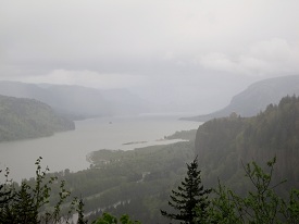
“…the river widens to near a mile, and the bottoms are more extensive and thickly timbered, as also the high mountains on each side.” – William Clark

Lewis Clark


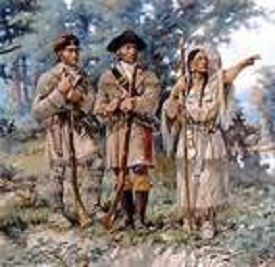
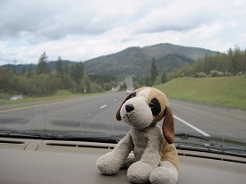
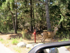
No, Guys… It’s over there…


(Caution: Learning Ahead) So the Columbia River had something to do with Lewis and Clark.  Lewis and Clark had something something to do with Thomas Jefferson, or was it Jefferson Davis?  Keep getting those mixed up. Some how Napoleon and Louisiana was involved and I think Teddy Roosevelt and Sacagawea had something going on. Clark died along the Natchez Trace in Tennessee.

IMG_6201a


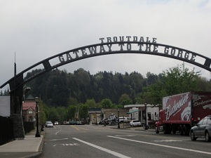
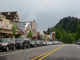
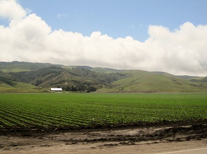
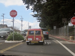
This is Troutdale – Gateway to the Gorge
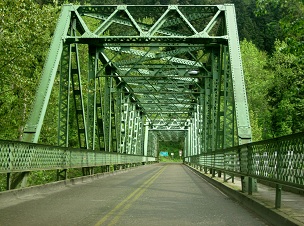
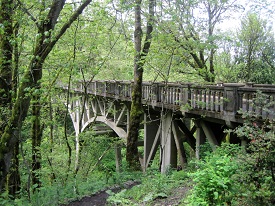
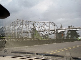


IMG_6202aIMG_6203a


IMG_6204a


Bridge


“The ideals sought were not the usual economic features and considerations given the location of a trunk highway. Grades, curvature, distance and even expense were sacrificed to reach some scenic vista or to develop a particularly interesting point. All the natural beauty spots were fixed as control points and the location adjusted to include them…..no consideration was given the commercial over scenic requirements. The one prevailing idea in the location and construction was to make this highway a great scenic boulevard surpassing all other highways of the world.”

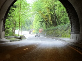
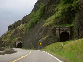
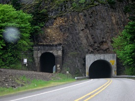
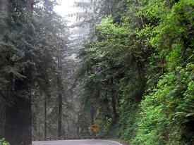
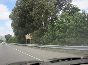
Don’t be fooled into taking the I-84 to see the Columbia River Gorge; it wasn’t built to the standards above. There is another road, sometimes marked as US 30, now called the Historic Columbia River Highway that was. Built by engineer/architect Samuel C. Lancaster in the early twenty’s, From Troutdale to the Dalles 75 miles away.

220px-Mitchell_Point_tunnel_(The_World's_Work)a


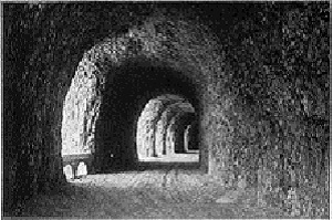
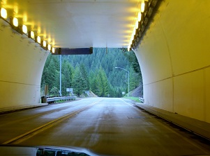
Some of the road is gone now, like the windowed tunnel, but what is there is spectacular and is well worth the price of admission. (there is no price of admission…it’s a public road)


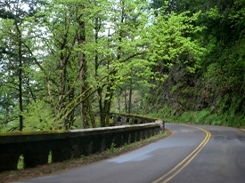
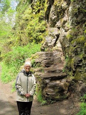
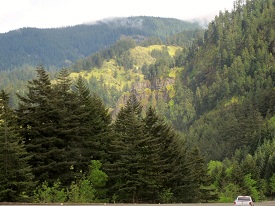
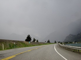
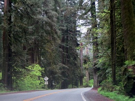
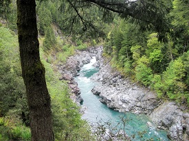
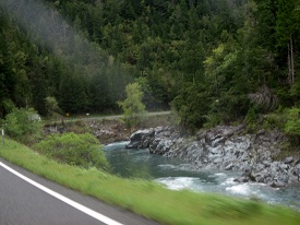
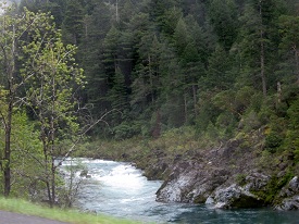
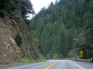
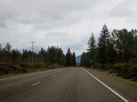
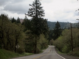
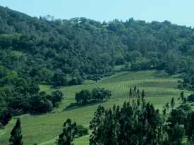
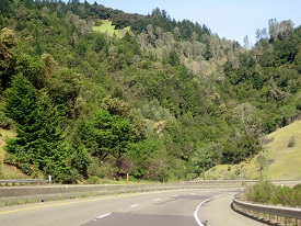
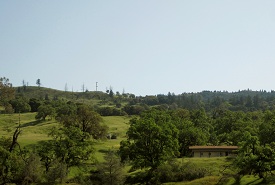
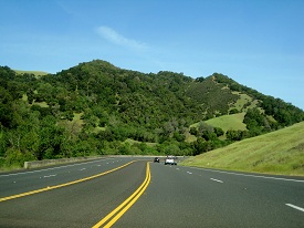
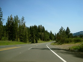
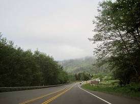
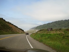
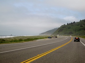
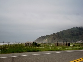
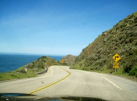
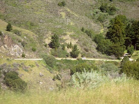
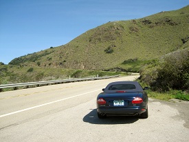
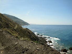
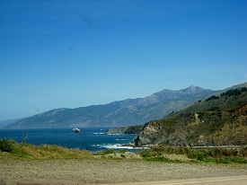
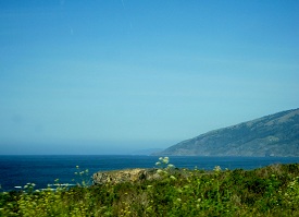
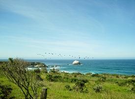
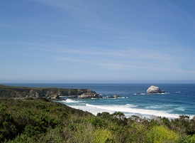
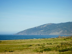
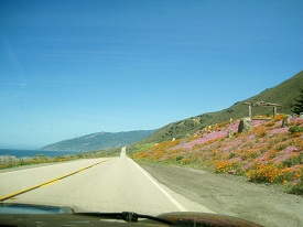
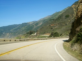
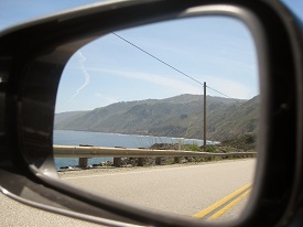
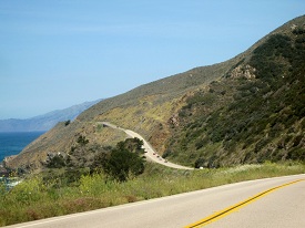
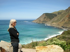
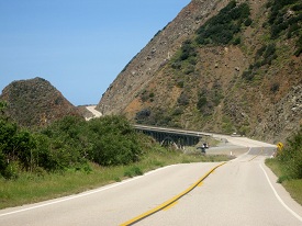
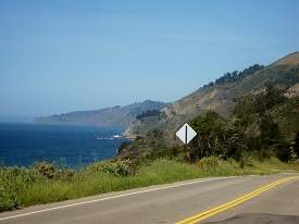
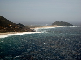
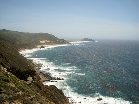
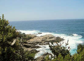
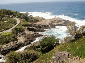
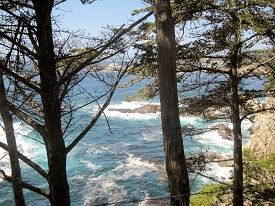
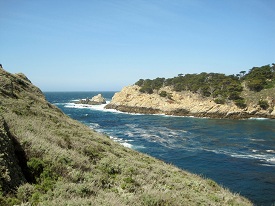
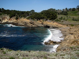
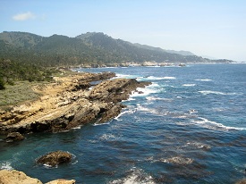
Some pictures from the road:

IMG_6210aIMG_6228aIMG_6239a IMG_6241aIMG_6226a IMG_6229a

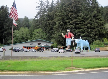
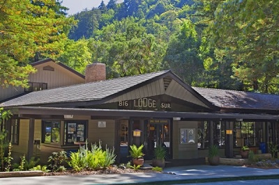
…and the rest area!!!:

IMG_6219a

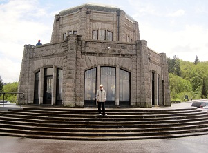
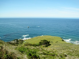
As Lancaster described it, the Crown Point promontory was the ideal site for “an observatory from which the view both up and down the Columbia could be viewed in silent communion with the infinite.” Such an observatory would also be a fitting memorial to “the trials and hardships of those who had come into the Oregon country.” And it could “serve as a comfort station for the tourist and the travelers of America’s greatest highway.” He suggested it be known as the Vista House.

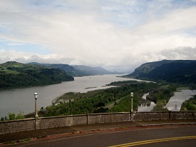
Views from the Vista House:

IMG_6214aIMG_6215a IMG_6216a IMG_6220a


IMG_6217a


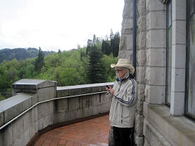
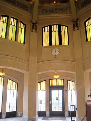
We just have one photo from inside, which is a shame, as this “rest area” would rival most any state capital rotunda. Marble floors, brass rails, cut glass windows.. they just don’t make rest areas like that anymore.


Batha


Hold on! We do have one more  picture – of the women’s comfort station.
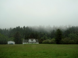
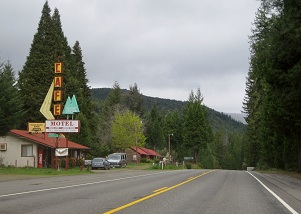
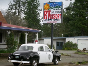
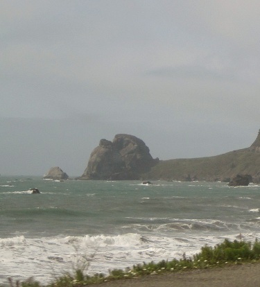
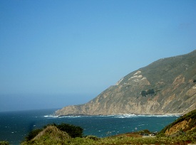


more roadside pics:

IMG_6234aIMG_6237aIMG_6243a IMG_6264a

IMG_6248a


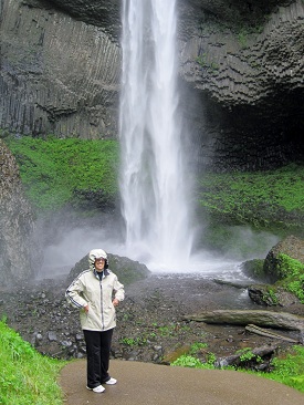
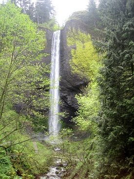
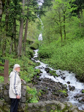
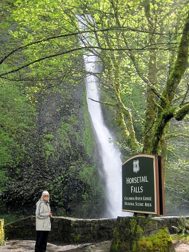
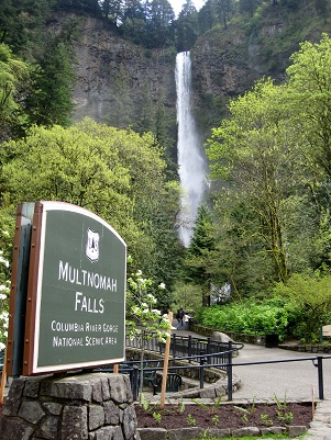
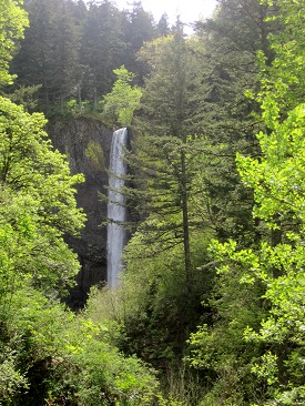
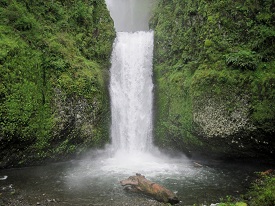
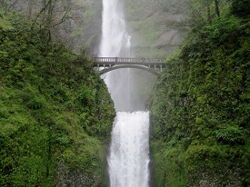
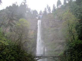
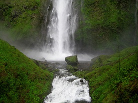
According to Indian lore, Multnomah Falls was created to win the heart of a young princess who wanted a hidden place to bathe.


The falls deserves its own section:
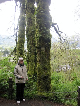
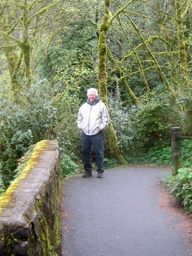
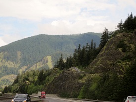
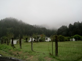
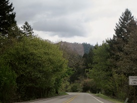
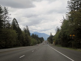
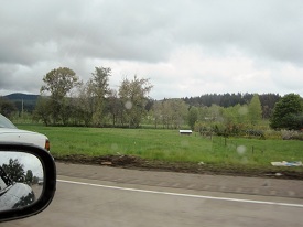
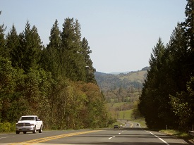
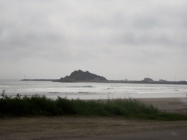
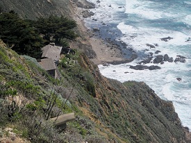
IMG_6252aIMG_6253a IMG_6255aIMG_6259aIMG_6256a IMG_6261a


More from the road:

IMG_6272aIMG_6273aIMG_6281a IMG_6274a

IMG_6277a


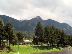
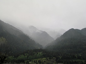
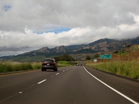
Mount Hood’s out there someplace.

Mount Hood, at 11,249 Oregon’s highest mountain  is considered the Oregon volcano most likely to erupt.


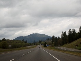
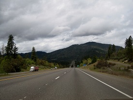
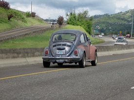
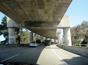
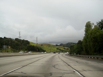
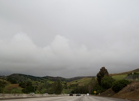
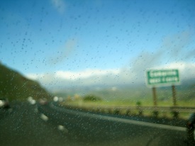
Eventually we had to join I-84:

IMG_6280aIMG_6283a


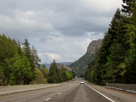
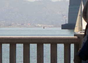
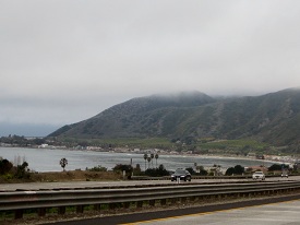
..and came into Hood River.  This area and the Gorge is famous for windsurfing and sail speed records due to the tunnel effect of the mountains, producing strong steady winds.

IMG_6288aIMG_6286a


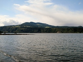
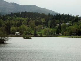
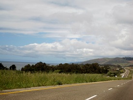
Unfortunately the sailboarders and winds had pretty much left for the day.  So we crossed the bridge into Washington State for the ride back to Portland.

IMG_6289aIMG_6290a IMG_6293a IMG_6294a


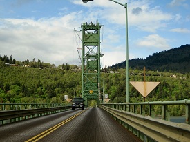
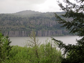
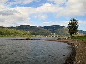
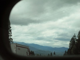
The Washington side was pretty, also.

IMG_6295aIMG_6299a IMG_6300a IMG_6304aIMG_6305aIMG_6307a IMG_6309a IMG_6315a


IMG_6324a


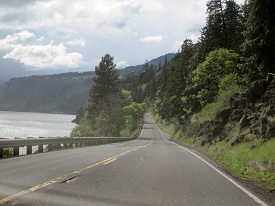
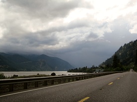
..and so with the sun (?) setting in the west, our day of exploring came to a close. We didn’t mind the sporadic rainy weather as it  made the many waterfalls just that much better.


 Next we go find Lewis and Clark 


So Where is the California/Oregon line anyway?

We woke up bright eyed and bushy tailed, hopped on 199 North out of Crescent City for the great State of Oregon. If we had more time (hey we’re retired, I thought we had all kinds of time) we would have continued up the Oregon coast on 101 as we had been told it was stunning. Maybe a trip specifically to do that? Anyway we went looking for Oregon:

IMG_6096aIMG_6097aIMG_6098a IMG_6103a

We followed this river:

IMG_6107aIMG_6108aIMG_6110a IMG_6112a


IMG_6125a


around a bend..


IMG_6127a


went through a tunnel..


IMG_6128a


…and then we think we found it. .. the GPS said we had crossed into Oregon. The “Almost Heaven” Cafe/Truck Stop/Motel/RV Park (with full hookup)/Welcome Center and Coke Machine was on our left.


IMG_6129a


..came over the hill and had to “jam on the brakes” to avoid the O’Brien, Oregon speed trap. Luckily, the LEO was inside taking a break.


Because we were in such a hurry to get to Montana (Mary’s brother Rex lives in Montana), we decided to run on I-4 up to Portland. These are some shots on the way to the I-4:

IMG_6130aIMG_6133aIMG_6134a IMG_6135a

As you can see it was a bit overcast, which is pretty much par for the course for the area.

IMG_6136a IMG_6137a


Then the I-4:

IMG_6138a IMG_6140a


The thing about expressways, and one of the reasons we have tried to avoid them as much a possible, is ya tend to get bored after awhile and attention wanders:

IMG_6141a IMG_6144a IMG_6169aIMG_6189a


IMG_6184a


Even the crew got bored and wanted to pose for a picture. Say hello to Duck, Lambie, Deer, Puppy, Horse, Dopey  Snuggs, Turtle and Roo. Roo is destined to belong to our newest granddaughter, Abby. While in the womb, Abby was called Roo by her parents, Pam & Charley.


IMG_6200a


We made it to Portland, actually Wilsonville, just south of Portland. The Jag found a friend.


We stayed in the Quality Inn (nice place) for a couple of nights. The sun came out -off and on – and it was cool.

We went for gas and learned something:  I got out, reached for the nozzle and this young man came out and said “I’ll get that for you sir…You can’t pump your own gas in Oregon”   Whoa Nellie!! Back the bus up! What da ya mean I can’t pump my own gas??  As the young man told me, it was against the law in Oregon for a “civilian” to pump his own gas. Oregon says it’s “OK” to pump something into your veins to commit suicide but it’s not OK to pump gas?? Does Oregon think the general driving public is to incompetent to pump their own gas? OK, might have a point there.

I have to admit my first reaction was just a tad over-the-top. After further review I discovered that way back in 19 and 51 Oregon passed a law that only trained employees of service stations were allowed to put “Class 1 Flammable Liquids” into cars.” The people of Oregon have had numerous chances to change the law but like it that way.

While standing there and talking to the young attendant I began to think .. “This is kinda cool” .. I actually do remember when this was normal.  You stopped at the station and someone would come out with a rag in his back pocket and ask “filler up?”  And I’d say with “ethyl”. Gas was only 25.9 cents a gallon so why not the “good stuff”. Then he would check the oil and clean the windows, might even check the air in your tires. I was awoken from my reminiscing when the young man said “all done… that’ll be $63.50.”   I asked the young man what he thought about the law and he said ” I have a job”. What more can you say?  When we got back home I asked my gas station owner friend why he didn’t bring back the “attendant”. He just looked at me like I was some kind of nut.

Oh, the part about checking the oil and cleaning the windshield – I just made that up.


Next up the Columbia River Gorge


Wine, Redwoods, and Song

We left the Bay Area intending to follow Route 1 along the coast the rest of the way north to Oregon but with the Jag giving us some anxiety, we instead took 101 to be closer to civilization. Still 101 is, in itself, a pretty drive.


IMG_5982aIMG_5983aIMG_5984a IMG_5987a


More scenery:

IMG_5988aIMG_5990aIMG_5992a IMG_5993a


IMG_5995a


another bridge..


IMG_5997a


….wine


IMG_6004aIMG_6005a


IMG_6006a


and redwoods,too..


IMG_6016a


As you may recall (if you have read the rest of this blog) this trip is part recreation of the one my parents took the family on back in ’65. One of the things we did was drive through a redwood.


IMG_6022a


So we did..


IMG_6025a


IMG_6026a


played a little, too…


IMG_6064aIMG_6065a


101 took a turn to the sea so we went with it:


IMG_6069aIMG_6072aIMG_6073a IMG_6074a


IMG_6086a


Oh Look!! Paul and Babe made it to the ocean,too..


IMG_6087a


Yup, definitely…


IMG_6093a


…ocean


Crescent City, near the Oregon line and the end of a long day.

IMG_6094a

That’s about it from California. What did we think of it?  Like most of the rest of the country there is the good, bad and ugly but we liked it and would love to go back and see more of it.

So where’s the song you may ask? Here ya go…Song

 Next up we find Oregon…we think..


San Francisco

The Golden Gate City -Shaky Town – The City – and if you really want to annoy a native call it “Frisco”

IMG_5842a


(Spanish for “Saint Francis”) was founded on June 29, 1776, when colonists from Spain established a fort at the Golden Gate and a mission named for St. Francis of Assisi a few miles away. The California Gold Rush of 1849 brought rapid growth, making it the largest city on the West Coast at the time. Also, it has a direct route to San Antonio, Texas as you can see.

IMG_5844a


There was a clean up campaign going on when we came into town. We contributed by tossing our trash at the bucket – I think it went in – hard to tell at 70 mph.


IMG_5846a

Candlestick Park? Nope – AT&T Park. Candlestick was to blase so the Giants (you remember the Giants right? Used to play in New York.) moved to Pacific Bell Park and fell victim to the Ma Bell break-up first becoming SBC Park and then AT&T Park when they were gobbled up by AT&T. Maybe Candlestick wasn’t so bad after all.


IMG_5848a


Three quarters of the city was destroyed by earthquake on April 18th, 1906…..what day is today???? April what????


IMG_5849a


We made it through….


IMG_5850a


Maybe should have taken the Hop On Hop Off bus.


IMG_5851a


We had mixed emotions when seeing the “Frisco” skyline, the coast highway had been so spectacular and few cars and then…..well it was still OK and to get to Fisherman’s Wharf you had to go into the City.


IMG_5857a


…a glimpse of the Bay passing under the Oakland bridge.


IMG_5858a


One of many wharves along the way.


IMG_5859a


well….maybe he’s saving toward a real drum..


IMG_5861a


Clang…Clang….Clang….. Went the Trolley… Ya I know its from Meet Me in St. Louis, but it fits so well and it is Judy Garland and she did movies and that’s Hollywood and Hollywood’s in California and so’s San Francisco. So there.

IMG_5866a


It would be great fun to come back for the Cup racing – we’ll see… While on the subject of the America’s Cup I think something was lost when the Cup went so commercial and team members could be from anywhere rather from the country they race for. I think Sir Thomas Lipton would be disappointed.


IMG_5871a


Oh! Look!! Dennis Conner!!


IMG_5872a


We parked and took a walk.  Don’t know if that’s a Wyland whale or not. Did you know Wyland is from Michigan? Madison Heights.. attended Lamphere High School, where his 25th “whaling wall” is in the pool area of the high school. Who’s Wyland you say? Well, look him up.


..and we’re walking…


IMG_5873aIMG_5874aIMG_5875a IMG_5876a


IMG_5878a


Bigger picture of Alcatraz. if you look real close you might see Sean Connery.


…more walking

IMG_5880aIMG_5879aIMG_5881a IMG_5882a


IMG_5885a


This is a Wyland. The one on the wall not the one in the hat.


We find Fisherman’s Wharf:

IMG_5887a


IMG_5888aIMG_5890aIMG_5891a IMG_5907a


Things took a turn for the weird.. but not being a native maybe this is normal:

IMG_5908a IMG_5909a

IMG_5889a

C.A.R.B.’s latest idea to reduce pollution in California.


IMG_5895a


Here’s one of those things you just stumble upon out walking….


Hyde Street Pier is part of the San Francisco Maritime National Historical Park:

IMG_5894a IMG_5896aIMG_5897a IMG_5898aIMG_5901a IMG_5904a

IMG_5905a

Then Mary saw this across the water….In 1849, Ghirardelli received news of the gold strike at Sutter’s Mill and sailed to California. After doing some prospecting, Ghirardelli opened a general store in Stockton, California, offering supplies and confections to fellow miners in town. Ghirardelli’s tent-based store was one of the first shops set up in the area. Several months later, Ghirardelli opened a second store on the corner of Broadway and Battery in San Francisco, which became, in 1852, his first establishment in that city. The rest as they say is chocolate.

As the sun was beginning to drop behind the chocolate it was time to get outta Dodge… er “Frisco”. Unfortunately the 101 was closed and as there was no ferry at Hyde Street Pier anymore we bravely headed toward the Golden Gate Bridge following detour signs through the city.

IMG_5911aIMG_5914aIMG_5916a IMG_5918a

IMG_5912a


We just managed to get out of the way of these guys.

Now where did that green VW go?


IMG_5921a


So here’s an idea. String wires above the roads and hook up like bumper cars – might work.


IMG_5923a


Bridge ahead!!


IMG_5926a


There goes my hat. Really liked that hat. Ben has one just like it. Have to get another one next time we’re in Az.


IMG_5933aIMG_5934a

Ah…“Frisco”.


Flower power2

.

.

PEACE!!

.

.

Next: We see a big tree…


Escape from LA and We See Hearst Castle, Elephants and assorted Wild Life

With some trepidation we left LA hoping that our steed would once again be trustworthy. The sky was overcast and gloom seemed to hang all around us.IMG_5636aSlowly we began to regain confidence in the Jag and the weather responded.

IMG_5637aIMG_5646aIMG_5639aIMG_5651a


IMG_5653a


Soon we were flying along enjoying the road, scenery, life….


IMG_5657


Does that really say 55?? I can’t drive 55!


IMG_5658a


Oh….


IMG_5660a


We see hills..


IMG_5665a


valleys…


IMG_5667a


and Lompoc  I almost forgot about Lompoc. Very long story ask me sometime and I’ll bore you with it. Lompoc is home to …..


IMG_5668a


Vandenberg Air Force Base. Good ole Vandyland. Brings back memories of how I learned to love the bomb. Never did find the ocean.


On the road again – Oh! I forgot as we were driving through Lompoc the Jag did its thing again as we pulled into a gas station for gas. As I was filling it up a lady said “what a pretty car … Oh its a Jaguar”.  I’m thinking for 50 cents I’d give it to ya, lady but she didn’t offer.

IMG_5675a


Country road..


IMG_5681a


for Hal…


IMG_5683a


Guadalupe…


IMG_5686a


….another for Hal


IMG_5690a


the back end of a Morris Mini Woody..very cool!!  but you would have had to  been there.


IMG_5693a

..San Luis Obispo

A long time ago, some Spanish dude traveled through here on his way to rediscover Monterey Bay, (apparently he had found it once but lost it.) The expedition’s diarist, some other Spanish dude, called it something in Spanish that means a bunch of bears because there was a bunch of bears.

IMG_5700a


country living…….


IMG_5694a


…big hill


IMG_5702a


San Simeon


IMG_5703a


“I would like to build something upon the hill at San Simeon. I get tired of going up there and camping in tents. I’m getting a little too old for that. I’d like to get something that would be a little more comfortable.” – William Randolph Hearst


Our view of Hearst Castle:

IMG_5705a


Patty? Patty? Where’s Patty

Sorry couldn’t help myself. By the way, the pic was taken through a telescope.

The Jag? What was wrong you say?  From the gas Station in Lompoc (you remember the gas station, right?) we kept going for a few more days and up past San Francisco without incident but then while motoring along at “speed” it did it again. We pulled off on a convenient wide-spot and after “it” ( I wasn’t feeling inclined to be kind) cooled off, I inspected the dealership’s work suspecting something had come adrift, but their work was fine and while wondering how much a tow was going to cost back to civilization  I pulled out the electrical plug on the other side of the one the dealership had replaced and lo and behold it was corroded, too. My trusty Swiss Army pocket knife scrapped off the corrosion and off we went. Wonderful people the Swiss. We drove the rest of the way around the country and back home without incident. Just so you know.


Big Sur

IMG_5707aBig Sur? Big Sur? What is a Big Sur? Careful, learning ahead: Big Sur is a sparsely populated region of the Central Coast of California where the Santa Lucia Mountains rise abruptly from the Pacific Ocean. The name “Big Sur” is derived from the original Spanish-language “el sur grande”, meaning “the big south”, or from “el país grande del sur”, “the big country of the south”, referring to its location south of the Monterey Peninsula. The terrain offers stunning views, making Big Sur a popular tourist destination. Big Sur’s Cone Peak is the highest coastal mountain in the contiguous 48 states, ascending nearly a mile above sea level, only three miles from the ocean. Told ya. 

IMG_5710a

First sight we stopped to see was this: Elephant Seals. Don’t let the pictures fool you these dudes are big – some over 5000 pounds.

IMG_5714aIMG_5713a

Can you see the attack squirrel in the second pic?

IMG_5722a

Did you know Elephant Seals can dance?

More from el sur grande:

IMG_5731aIMG_5732aIMG_5735aIMG_5740a IMG_5750a IMG_5752a IMG_5756a IMG_5757a IMG_5759a IMG_5760a

and some more el país grande del sur:

IMG_5761aIMG_5762aIMG_5767aIMG_5765aIMG_5770a IMG_5773aIMG_5776a IMG_5777a


Driving Big Sur – Wild!! (remember blue = video)


BigSurLodge


We stop to eat.


More disgustingly pretty pictures:

IMG_5792a IMG_5793aIMG_5794a IMG_5795a IMG_5802a IMG_5805aIMG_5807a IMG_5808a IMG_5809a IMG_5818aIMG_5819a IMG_5824a


We saw wildlife along the way, too.

IMG_5812a IMG_5813a IMG_5814a IMG_5820a IMG_5821a IMG_5829a IMG_5830a IMG_5832a


Harbor Seals were cute so one last video of Seals in the sand.

Next stop San Francisco!!


HollyWoooooodddd

(We do LA and the Jag does us – again.)

Hang on this could get rough!!


We cross a bridge.


Is that smog? Thought C.A.R.B. had that all cleaned up with all those Prius’s (Priui ?  Prium?),  electric cars and what-not?? (Snicker)


Down we go…


One last clean breath!


Past Roy Rogers Dr.


I really wanted to visit the Roy Rogers Museum, but it was moved to Branson, Mo then closed. They even sold Trigger. Can you believe that???


San Dimas? Hey! I remember San Dimas !


Pasadena?  Pasadena? Why is that familiar?


Oh!


We go to the Rose Bowl


Sign said Rose Bowl this way.  How do they get those floats down such a narrow street?  On TV it seems so much bigger.


Then hit Colorado Blvd. 

There was this little old lady in a red car next to us at the stop light. Something about we couldn’t beat her Super Stock Dodge. Not sure what that was all about.


Sure sign you’re in Hollywood. The billboard says check your wiener – free STD checkup.


Yup, Hollywood alright. We tried to drive up to the sign but couldn’t get there from here.


Frederick’s of ?


Grauman’s Chinese Theater.


Better Picture of GCT


We stumble on to Beverly Hills

We couldn’t find Jed or Axel, but we did get lost.


Oh look!! Rodeo Dr. In Texas that would be Rodeo (ye haw) Dr. Go figure


More of Rodeo/Rodeo Dr


Rodeo and Wilshire Blvd.


Rodeo and Wilshire + Maserati – probably Lindsay Lohan

We reach the sea!! 


…and the end of Route 66, the Mother Road at Santa Monica Pier


so we drove out on to the pier


Tried not to run anybody over…


.


had our picture taken by Julie and Chris Harris from Camden NSW, Australia. We took their picture and they invited us to stay with them when we make it to Australia so we invited them to Clio


Mary’s friend Ila’s son’s friend owns this stand on the pier. The guy she is talking to is not Ila’s son’ s friend. Confused yet?


No bikini’s today!


We had lunch on the pier and drove back up to the main drag and the Jag went bonkers. It was wall to wall traffic, it is Los Angles after all and we were in “limp home mode” or whatever you call it. Same thing that happened in Orlando. Mary had the GPS look up Jaguar dealers in the area.

There was one in BEVERLY HILLS only 2 miles away. Ya right, like we were going to stay in Beverly Hills till the car was fixed. There was another dealership about 12 miles away in Van Nuys so I called them and they said they closed at 6 and could we make it? It was only 4 so I said sure no problem. I forgot we were in LA at rush hour. We made to the dealership about 10 minuets to 6. Wow 2 hours to go 12 miles. What a rush.

Our concierge, Val (see Orlando escapade for details of Jaguar concierges).

We found out they would need to keep the Jag over night so we had to find a place to stay. Luckily for us there was a Quality Inn on the same block so we booked a room for 2 nights.

The dealership is Galpin Auto Group, the worlds largest Ford dealer plus – Jaguar, Lincoln, Volvo, Subaru, Honda, Mazda, Lotus, Aston-Martin, Spyker (what ever that is) and Galpin Auto Sports (Pimp My Ride and the new Knight Rider Mustang). They occupy the whole city block. Anyway our concierge suggested that we not walk the streets at night and that if we got bored the next day we could visit the museum (Oh, they have a museum, too) next door. I had somehow forgotten we were in Southern California which was home to all sorts of car crazy people. The museum was cool! Did I mention that when they weren’t busy, Galpin also rented cars to the movie industry?


We started off with Liberace’s wheels.


Mary talks with Herbie, the Love Bug.


Ramone??


Then a bunch of Big Daddy Ed Roth’s creations:


There were several old classic cars, Jaguars and cars being worked on for the Barrett-Jackson Auction.

Then we had lunch at the Galpin restaurant, the Horseless Carriage.

So, although the reason we were in Van Nuys wasn’t all that great, the stay was fun!

What was wrong with the Jag you ask?  It seems Jaguar used gold plated connectors on the engine throttle body, but tin connectors from the wiring harness and everybody knows tin and gold don’t mix, just look at the periodic table. So declining the offer by the used car manager to buy the car, we went our merry way. A little wiser …… a lot poorer…

…….a little slower


 Next stop: the coast highway and Hearst Castle


California Dreaming

From the Grand Canyon we stopped one last time with Doug and Gail Sweet.


But Lake Havasu was getting a little crowded..


..and a bit weird so after a few days we bid the sweet Sweets ado and started for sunny California.


Still wanting to ride the “Mother Road”  we got off I-40 as soon as we could.


We hit the the state line. No check points except for the fruit thing. I guess there are already enough fruits and nuts in California.


I vaguely remember Needles from the trip with Mom and Dad. Didn’t seem to have changed much.


After Needles we followed 66 out into the Mojave toward Barstow. California Dreaming video.


Along the way we discovered miles and miles of names written with rocks by the side of the road. We figured it was done by “dust bowl” refugees from Kansas.


We lived in Kansas for 3 years so we added ours.

I could be wrong about the “dust bowl” thing. The rocks might have rearranged themselves into names by chance. Death Valley has its “walking rocks” so why can’t the Mojave have spelling rocks??


Speaking of Death Valley, is that borax in them thar hills?


Unexpected was all the vulcan activity (where is Spock when you need him?) along the way. Lava flows and volcano cones everywhere. Thought we were in Hawaii.


Barstow:

The settlement of Barstow began in the late 1840’s. Every fall and winter, as the weather cooled, the rain produced new grass growth and replenished the water sources in the Mojave Desert. People, goods and animal herds would move from New Mexico and Utah to Los Angeles, along the Old Spanish Trail from Santa Fe.. yada, yada, yada.


We found good vittles at the Bun Boy Restaurant recommended by the motel we stayed at.


Our motel . The world famous “Route 66 Motel”. As seen on TV and the odd travel log.


Why, yes it is the one with the round beds!


As with many of the sights along 66, the owners had/or were in the process of restoring classic examples of Mother Road lore. and yes that is the maid. A true full service motel.

We do some sight seeing:

This is the Barstow train station and Harvey House.   

Fred Harvey is credited with creating the first restaurant chain in the United States. Harvey and his company also became leaders in promoting tourism in the American Southwest in the late 19th century. The company and its employees, including the famous waitresses who came to be known as “Harvey Girls”, successfully brought new higher standards of both civility and dining to a region widely regarded in the era as “the Wild West”. The popularity of the Harvey Girls grew even stronger in 1946, when Judy Garland starred in the film version of Samuel Hopkins Adams’ novel The Harvey Girls.


Harvey Girls were to be  “single, well-mannered, and educated American ladies,18 to 30 years of age, of good character, attractive and intelligent”. Harvey Girls were required to enter into a one-year employment contract, and forfeited half their base pay should they fail to complete the term of service. Marriage was the most common reason for a girl to terminate her employment.

Right: Judy Garland as a Harvey Girl (with escort)


The Barstow Route 66 Museum. It was closed.


The Mojave River. Apparently it was closed, too.


The MacDonalds was open for business! Next time we’ll stop there.

We were getting tired of the sight seeing and the drive from Lake Havasu had been long so…


…. good night. Next stop LA.


We find a BIG HOLE


From the top of Oak Creek Canyon the drive to Flagstaff, being only 12 miles, was uneventful.


Except for the cow.


We spent the night in Flagstaff and headed north the next morning.


We drove and drove some more. Road to the Grand Canyon video.

Should we have taken the train from Williams? Maybe next time. Eventually we got to the place or at least the parking lot. Mary headed for the visitors center but because I had been to the Canyon many, many moons ago suggested that we should walk up the sidewalk a little way first. Mary sees the Grand Canyon for the first time.


Later describing her first look, she said “can you imagine riding up here on your horse, not knowing it was here??? Whoa!! Dobbin!!


The Grand Canyon is 277 miles  long, up to 18 miles  wide and attains a depth of over a mile (6,000 feet ).  the area has been continuously inhabited by Indians who built settlements within the canyon and its many caves. The Pueblo people considered the Grand Canyon  a holy site and made pilgrimages to it. The first European known to have viewed the Grand Canyon was  García López de Cárdenas from Spain, who arrived in 1540. See above picture for details.


After Garcia’s unfortunate mishap, a railing was installed.


Puppy and Deer play on the rail…


……..and on the wall.


The Grand Canyon has mountain lions, rattlesnakes and attack squirrels.


Right after this picture was taken an attack squirrel tried to run off with Puppy. Mary and Deer had to chase him half way down the Canyon.


Each year, thousands of hikers enter the Grand Canyon on the Bright Angel
Trail. They follow a route established by prehistoric people for two key reasons:
water and to pay homage to García López de Cárdenas from Spain. First European to see (briefly) the bottom of the Grand Canyon.


Some of the trail down to the floor of the canyon. Its about a 2 hour trip down…


…and a 4 day trip up counting cardiac arrest, recovery and rescue by mule.


When you get down there you can rest here if you have reservations.


Puppy and Deer find yet another place to play.


Statue of García López de Cárdenas.

Lifelike isn’t it?


Artsy shot.


‘nother artsy shot.


yet another.


and some more.

Alas! All good sight seeing comes to and end …..


…. and we need to get the elk outa here.


Good night  García López de Cárdenas. Where ever you are.


Sedona, Arizona

After a rather long hiatus from working on our trip blog we’re back on the road again heading away from Ben & Bette’s (who, despite what you may have heard are truly wonderful people).


On the way to Sedona, B & B had suggested that we check out some Indian ruins. (Yea, I know PC is Native American but in my own warped mind I consider native to mean always been there and while “native Americans” have been here quite a spell, there is that land bridge thing so how ’bout I just go with tribal?)  So the Tribal ruins called Montezuma Castle are pretty cool and are some of the best preserved of the pueblo ruins.

Some pics:

and a couple of vids: Castle and Arizona Sycamore

Moving on:

.

.

Goats.


The sign to Sedona.  Sedona was named after Sedona Arabelle Miller Schnebly (1877–1950), the wife of Theodore Carlton Schnebly, the city’s first postmaster, who was celebrated for her hospitality and industriousness   Bet you didn’t know that, huh!


Sedona is also famous for the “Red Rocks of Sedona”. As we drove north to the town we began to see why:

We stopped at the Red Rock Ranger Station to stretch our legs and snap a few more pics.

With our legs a little longer we headed into town.

Did I mention its a ways into town?

Finally!! And what’s with that little red car??


We didn’t have time to “do” Sedona, so we parked and had lunch at the Oaxaca Rooftop Cantina. Oaxaca is the name of one of Mexico’s 31 states. Bet ya didn’t know that,either.


The rooftop.


The view


Us

We met this couple who lived just down the road (they took this picture) who were celebrating his birthday (sorry no picture) and they invited us to stay the night at their house – maybe next time.

With lunch over it was time to hit the road.

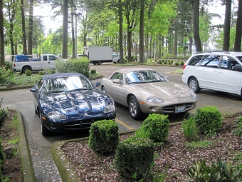
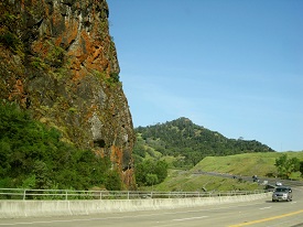
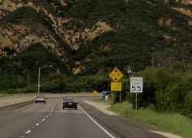
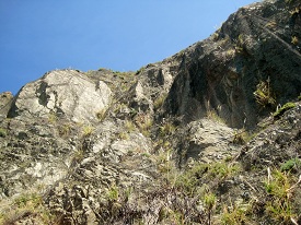
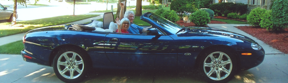
Between Sedona and Flagstaff is Oak Creek Canyon. 13 miles of cliffs, waterfalls, falling rocks, great scenery and hair pin curves – just the place for a Jag convertible.

South entrance to Oak Creek Canyon.


Up the Canyon:


Little video on the way up Oak Creek Canyon.


At the top Mary pointed out something we haven’t seen for awhile.


Information:

There was a little ‘flea” market at the pull off and we bought T-shirts and a Christmas ornament from the indians.


Mary takes a brave – but quick peek at where we came from.


Where we came from:


NEXT

On to Flagstaff and the really BIG hole in the ground.


Sweets kick us out and we end up in Cave Creek, Az

Doug & Gail Sweet finally kicked us out so we headed back east to spend some time with Ben and Bette Munger.

(Doug saying “You’re STILL here???) (Note: BLUE indicates video or music)


Ben and Bette live in Cave Creek, Az which is just north of Phoenix.  Rather than back tracking we decided to go south to Parker and then east on “back” desert roads.

Parker Dam is what holds back the Colorado River to form Lake Havasu. Some pics of the dam. (These were taken from the California side so we weren’t technically in Arizona at the time…but don’t tell anybody.)

It is amazing to me that there can be all that water and yet it is desert right to the water’s edge. I understand climate zones and all that, but it is still amazing!!

After spending a few minutes talking to a couple from Colorado who are building a place in Lake Havasu, we continued our journey to Cave Creek. Strung out along the Colorado River are “oasis’s (oasii?) containing little settlements, mostly RV parks and at least one golf course. The golf course had holes on both sides of the road with tunnels under the road to play through. I wondered if you were supposed to hit over the road or try to hit the ball through the tunnels. I didn’t stick around to find out.

Our route took us through the La Paz Desert:


.

.

Not much out there. We did, however, go through Hope.


.

Then we were beyond hope.

.

.

.

Some more desert:

.

.

As we approached Cave Creek Mary became obsessed with Arizona’s State Tree. I had to edit hundreds of pictures of these things.

.

Actually Arizona doesn’t have a State Tree as far as I know, but the State Flower is the Saguaro cactus flower. The Saguaro cactus is native to Arizona and is in abundance around Cave Creek. It grows to a height of forty to fifty feet and lives to an age of 150 to 200 years. So if it wants to be a tree, its OK with me.

.

.

We arrive at Ben & Bette Mungers:

.

.


.

.

This is Ben showing Mary some of the landscaping. They have a beautiful home surrounded by  desert flora and fauna.

.


I tried an experiment of doing more video at Ben & Betty’s:

.

.

Front yard (remember blue =’s video)

.

.

.

.

These are some pics of Ben & Bette’s back yard:

.

.

.

.


Snakes. Why did it have to be snakes???

.

.

.

.


B & B (Ben and Bette) took us in to Cave Creek/Carefree to see the sights. The first thing is the big pile of rocks just before town.

Not sure the significance of the rock pile but the locals paint themselves blue and sacrifice virgins there.. no wait that would be the Druids. Anyway the Cave Creek dwellers hold the pile sacred in some manner.

Hooked onto and intertwined with Cave Creek is the town of Carefree which has its origins in some sort of scuffle between the Cave dwellers back in the ’50s. So several of them moved across the road and established Carefree, Az.

Carefree has interesting street names and gives insight to the residents state of mind:

The first street sign pic is the corner of Nonchalant and Elbow Bend Rd in case you can’t make it out. There is also Ho Hum, Tranquil, Lucky, etc..

Stagecoach Village is a spot that highlights the economy right now. Built to take advantage of pre-collapse America it is like a modern day ghost town.

Stagecoach Village is sort of ‘tween Carefree and Cave Creek like a transition zone. Cave Creek is much more cowboy’d up.

Mary and horses videos: OneTwo (Note the horse sunglasses.)

We had lunch at the Horny Toad, hot spot for the Cave dwellers: 

Ben & I found these nice matching Zonie hats to make us look more Cowboy. Ben had been saying he was feeling a little out of place driving a Prius without a gun rack and having no hat. The hat we could fix. The Prius….


Some shots around Cave Creek:

I really can’t do Cave Creek justice with photos. You have to go there.

.

.

.

Mary is seen here explaining to B & B that she would like to go to a real cowboy place to eat. So they took us to:

.

Harold’s Corral, sorry no pictures from inside (not allowed) but I can tell you the food was very good and the table didn’t fall down after Ben fixed it. Just kidding about the “not allowed” thing. Not sure why I didn’t get any inside shots, it might have something to do with the friends B & B invited along Jeff & Jane (not real names) who were in the witness protection program.

Like all good things our time with Ben and Bette was nearing its end so Mary and I took a short walk around the neighborhood.

and watched the sun set one last time before hitting the road again.

Hey!!  Wait!!  That’s not how it happened!  Ben & Bette LEFT us. Unlike the Sweets who finally had to throw us out, the Mungers just up and left, telling us to put the key under the rug when we decide to leave. I know we can be, maybe just a little, obnoxious and get on one’s nerves just a little but really are we that bad???

And away they go.

All kidding aside, we had a wonderful time with Ben & Bette and hope to look them up again next time we’re in Arizona. But we’re going to hide the keys.

Next stop Sedona and the GRAND Canyon.